
Get Ready for a Gulf Coast Hurricane
Get ready. A storm is coming…
One of the most consistent things I’ve ever seen in my career as a meteorologist is that when you have a wet May in Houston, you will get a hurricane hitting between Corpus Cristi and New Orleans between August 1 and September 15. Every time.
It was a very wet May in Houston this year. Guess what comes next.
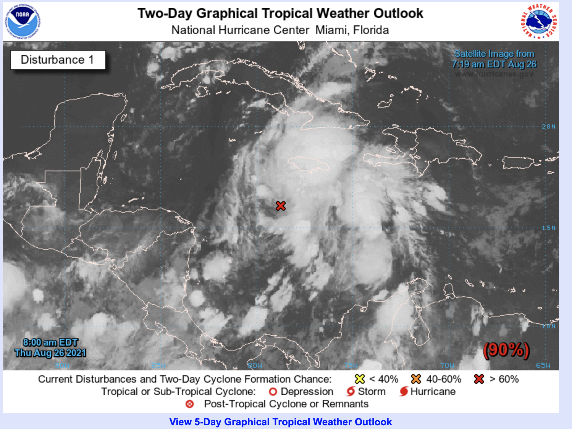
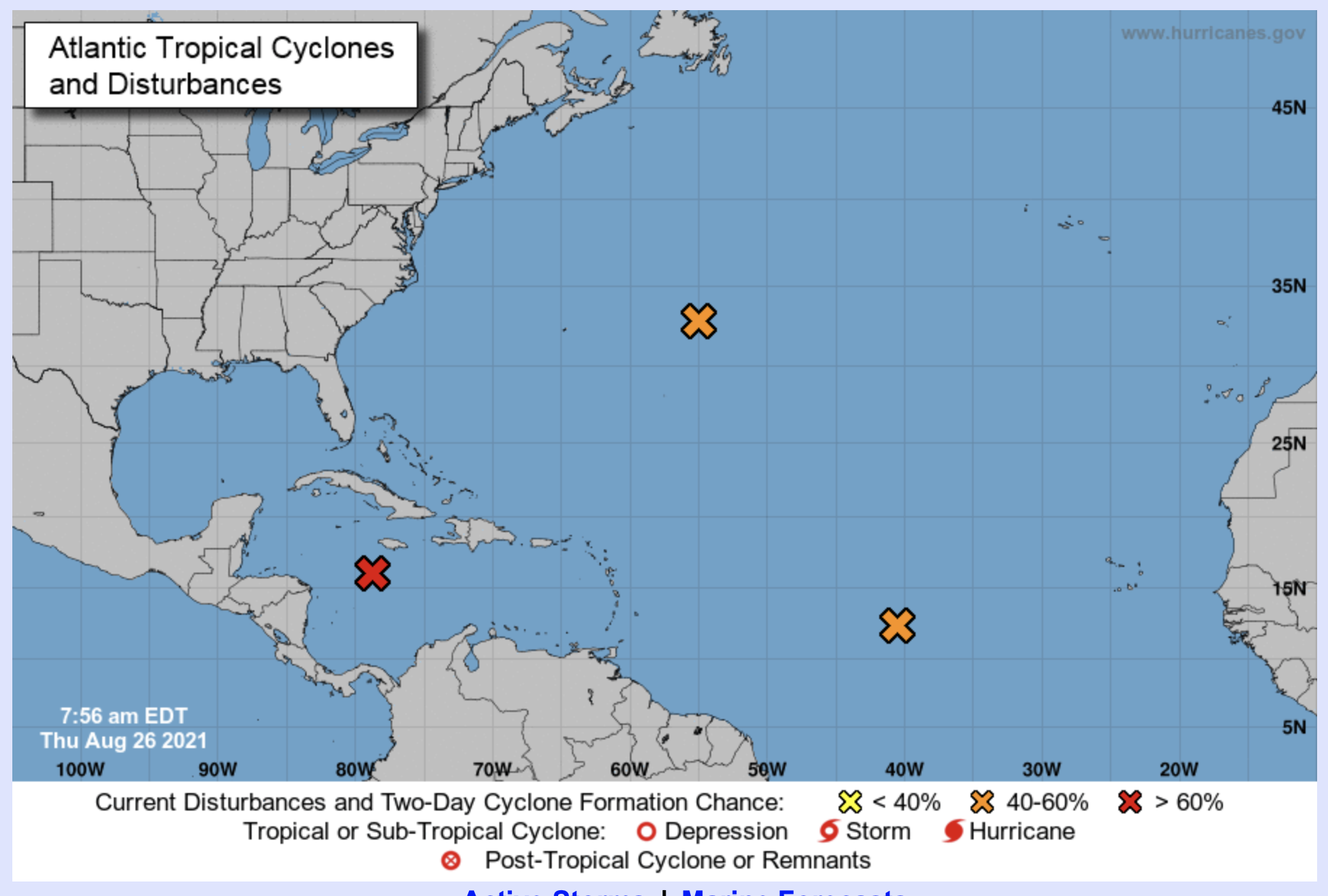
This is Tropical Depression Nine. It’s currently sitting southwest of Jamaica, and is traveling northwest at 9 mph. You’ll notice that it doesn't look that organized right now. That will change.
Here’s the first official track from the NHC on Tropical Depression Nine.
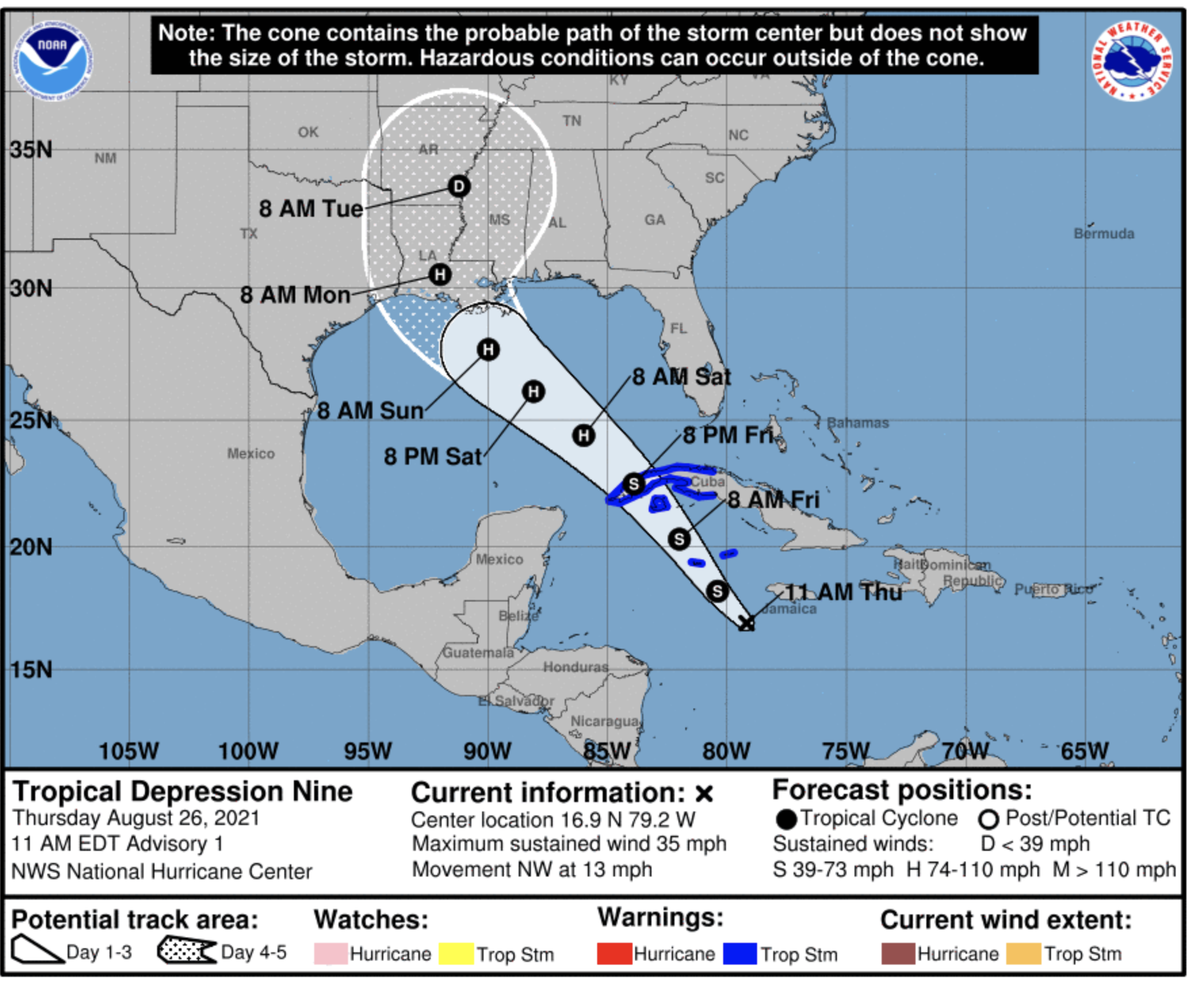
Notice how the track takes this storm into the Gulf of Mexico where it strengthens to become a Hurricane. Frankly, this storm could become a major hurricane before landfall in Louisiana. The NHS track is right in line with the computer models, and I think is very good at this point.
Here are some of the spaghetti plots (ht to tropicaltidbits.com)

So, there isn’t much wiggle room in the models as you can see. And, I don't really think there’s going to be big changes with this track going forward. Let me show you why.
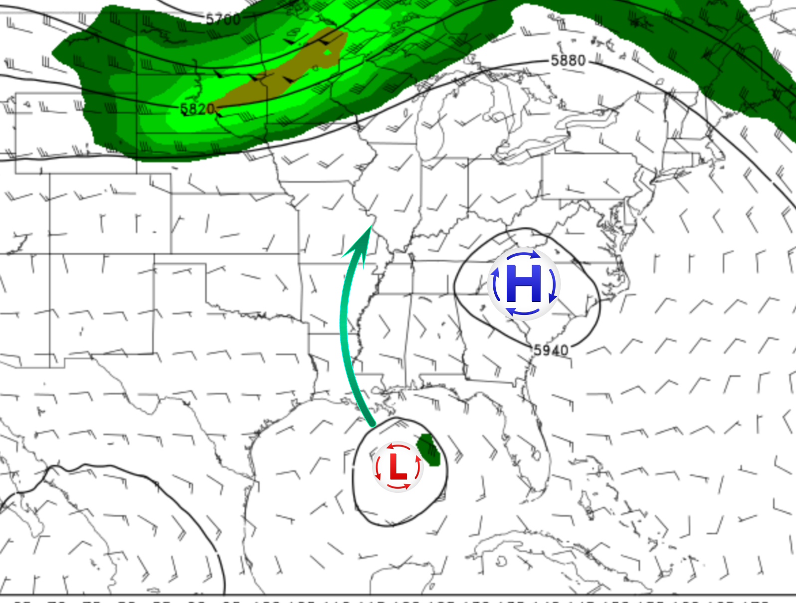
This is from the GFS Ensembles showing pressure and winds in the upper atmosphere (500mb). I’ve added in a High Pressure over the Carolinas and the Low Pressure over the tropical system coming into Louisiana. (This is for Sunday morning.). That high pressure over the Carolinas will act like a block for the storm, preventing it from moving any further to the east. High pressure steers the paths of hurricanes since they are always looking for the path of least resistance to move heat from the tropics towards the poles. This storm is going to want to move north, and the high pressure in the Carolinas will give it a path up the Mississippi. It could drift west if the high pressure comes in stronger than expected, but it won’t have the freedom to move much further east.
Bottom line is the models look to have a really good handle on this storm right now, and the NHC’s guidance is right in line with the models. So, for a storm that’s this far out and newly formed, I have pretty high confidence in the forecasts you’re seeing.
Let me show you two examples of what the models are saying could happen, so you can see the full range of what’s likely to happen at this point.
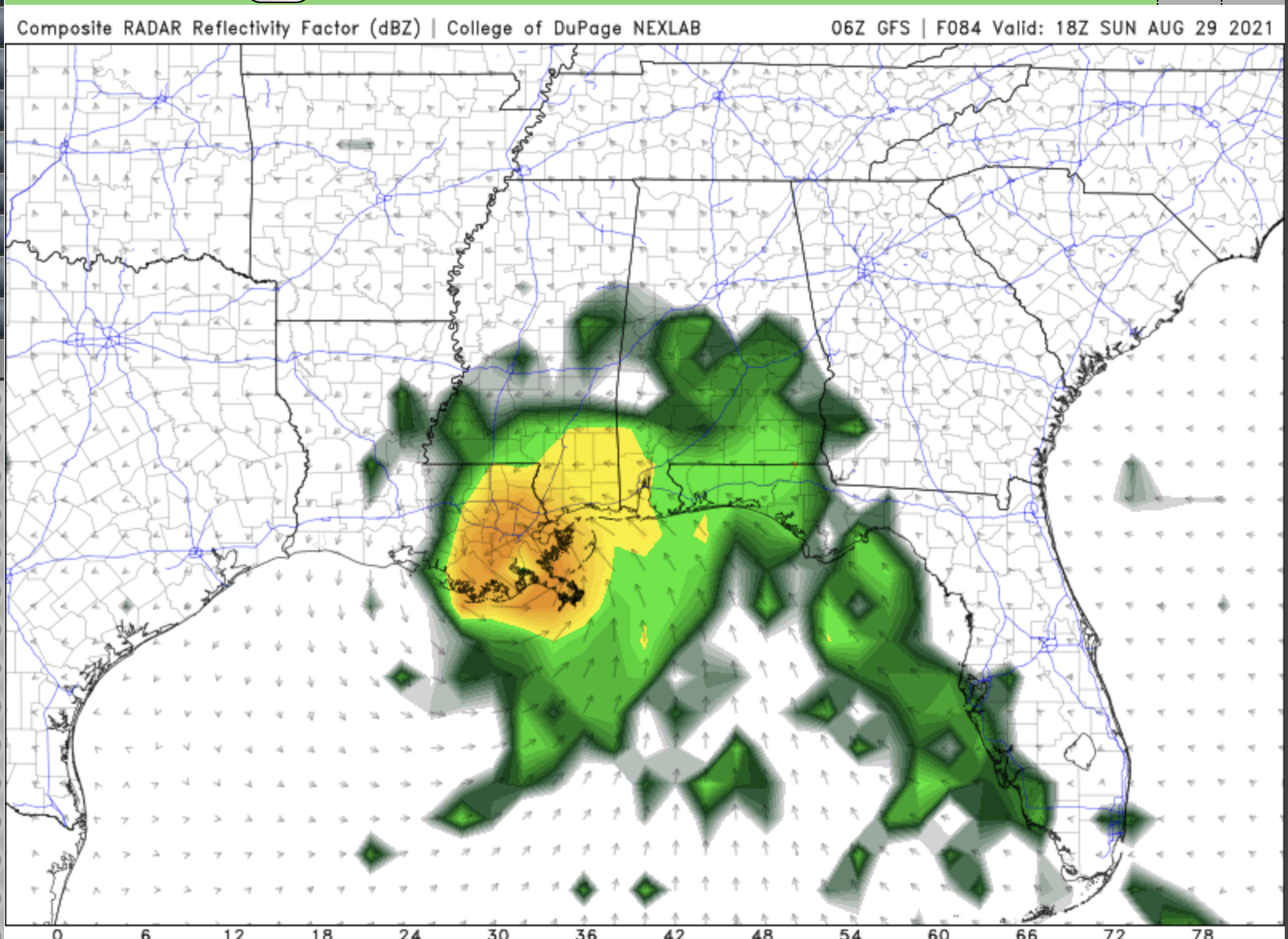
This is the GFS simulated Radar for Noon on Sunday. It’s putting the eye of the storm coming ashore just southwest of New Orleans. There’s a ton of rain falling in that area, and you can even see an outer rain band flirting with the Florida coast. This is an example of about how far east this storm could go.

This is the NAM for the same time, Noon on Sunday. This model has the storm further south and west of the GFS. It would eventually bring the storm ashore in south central Louisiana, just south of Lafayette. This is one of the more western runs for this system, and I don’t think it would get much further west than this.
So, those two models show you the range of what’s expected right now. Both are bringing in a hurricane into Louisiana late Sunday or early Monday. There is the potential for this to be a Cat 3 or higher as it arrives.
The good news is you have time to prepare!