
Positive Signs: Christobal Update
In the latest update, there’s more good news than bad. It’s looking like we can eliminate more locations as landfall targets and it’s looking like the potential for massive flooding is decreasing.
Let’s start with landfall. It’s now looking like the target region for landfall is really from Alexandria on the West to New Orleans on the East - Acadiana to the toe of the Boot. That means Lake Charles and Beaumont (and Houston) are not in the direct path for the center of the storm - the area that will have the highest winds.
It’s also looking like the potential for massive flooding is decreasing. Earlier in the week, we were concerned with the potential for an upper level high pressure system to temporarily block the northward movement of the storm and force it to drift to the west. That would keep tropical rains falling in the same location east of the center of the storm for 24 hours.
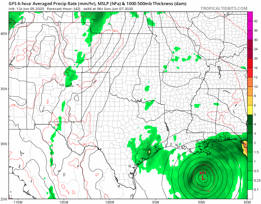
Now, it looks like that high pressure isn’t going to be as strong as we initially feared. That means instead of forcing the storm to drift west, it’s simply going to cause Christobal to jog left and keep going. The animation of the GFS model above shows that little jog (although I think the model has the jog left coming later than it actually will. I’d put the whole storm just a little west of what this animation is showing and make the jog happen a little sooner).
So the end result is while there is still going to be tropical downpours and some storm surge flooding, it’s not going to be on the same level as it would have been had Christobal stalled. New Orleans, Biloxi, and Mobile will all get drenched, and tornados are likely to spin up quickly in those rain bands. But, in general, a storm that keeps on trucking is much, much less dangerous that one that sits and spins.