More rain Tuesday, Storms Wednesday
Rain will continue to fall across portions of the South on Tuesday with some big, bad storms possible Wednesday.
Several inches of have have already fallen from East Texas to Alabama. It appears the worst has been from Northeast Louisiana to just north of Jackson, MS and into Birmingham, AL where some pockets of 4-5” are being estimated by radar.
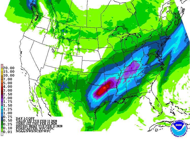
Tuesday looks to bring additional rain, but it may not be as heavy as what’s expected on Wednesday. The graphic below shows the additional rainfall potential through Wednesday. It shows mainly 1-3” of rainfall across NE TX and SW AR.
Source:
48 hour rainfall potential from the Weather Prediction Center.
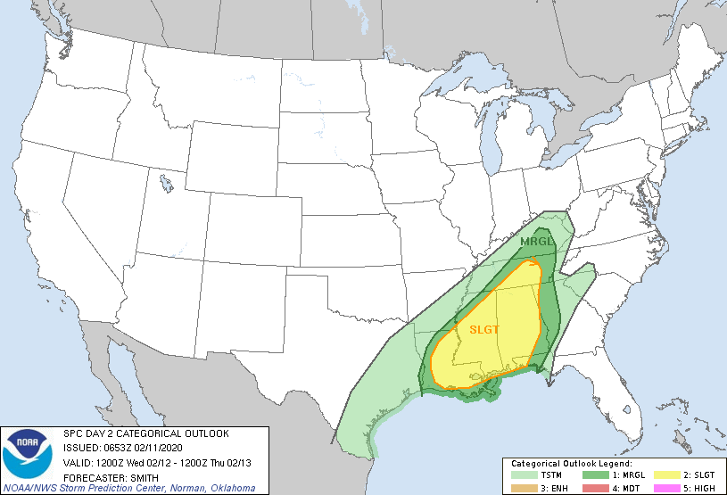
Another system will move across Louisiana and into Mississippi and bring the threat of a line of big, bad storms during the afternoon. The main threat from this will be damaging wind gusts, but a few tornadoes are possible.
We will be watching how things materialize and will launch the Live Big Bad Weather Blog to answer questions in real time if need be.


