
How Much Ice
There are a few slight changes to our forecast for this next winter event. The latest run of models brought some cooler air a little further south than the previous models were seeing. That means some wintry mix on the north side of Houston. It also means things start off as snow along I-20 between Tyler and Shreveport and Ruston before they turn over to the ice and wintry mix.
So, the big question is how much ice and where. One of the things that starts to give a forecaster confidence in the forecast is when the computer models start to come into agreement. So, I looked at the ice accumulation for three separate models - the GFS, the NAM-NEST, and the HRRR. Here they are…

GFS - Ice Accumulation by Thursday morning.

NAM-NEST - Ice Accumulation by Thursday Morning
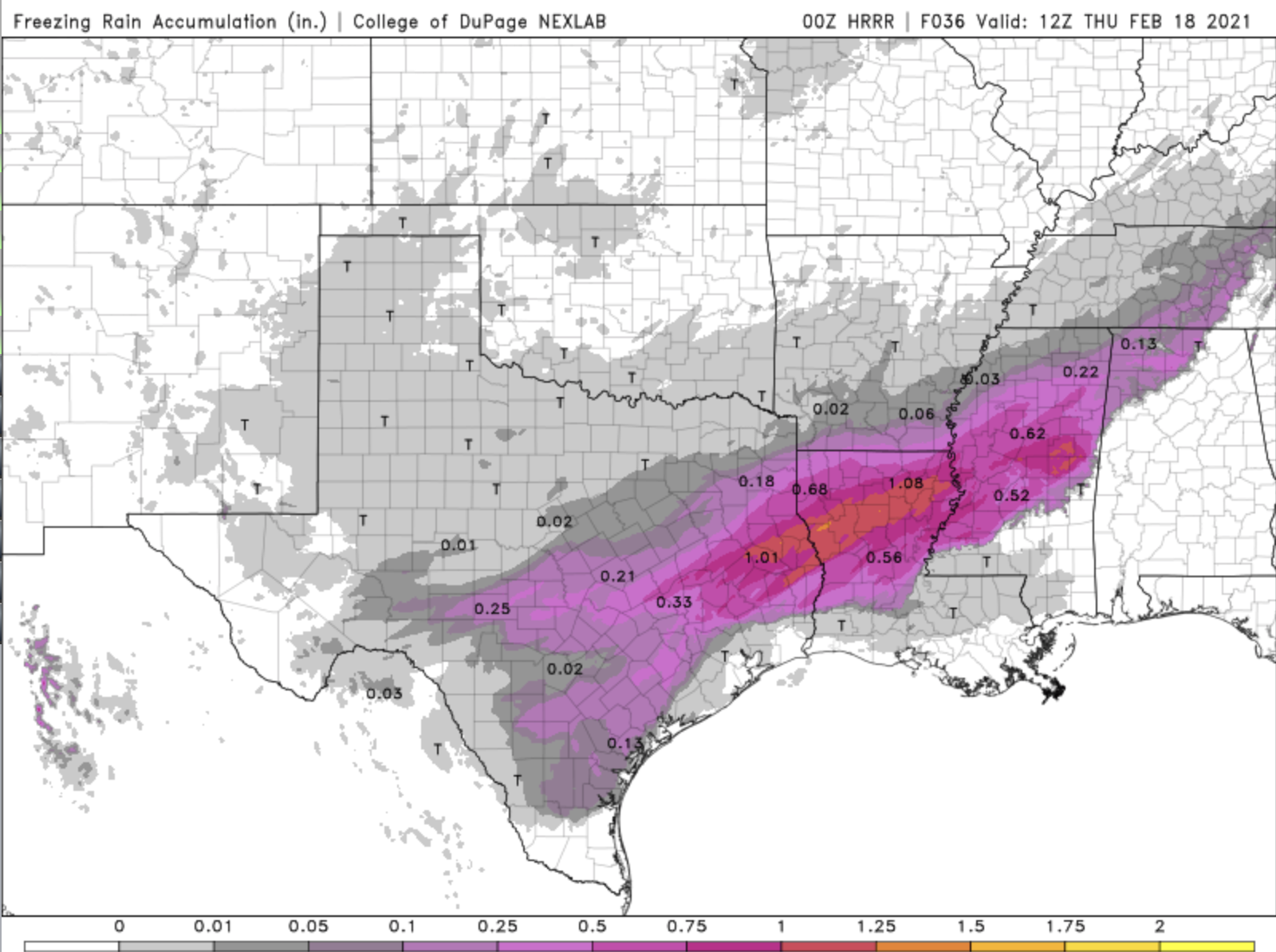
HRRR - Ice Accumulation by Thursday morning
All three of these models are showing a band of ice running from Central Texas, to the Gulf Coast, and up through Louisiana and into Mississippi. They are also all three showing a bulls-eye of ice accumulation greater than half an inch from about Lufkin, TX, into Louisiana, including Shreveport, Natchitoches, Alexandria, Ruston, and Monroe. That would be enough ice to bring down power lines and tree branches.
In short, the forecast is still calling for a big, fat, cold mess.