
The Latest on Laura
Update: 1PM
Laura has become a Cat 4 Hurricane. We were saying for a couple of days that it could get to at least Cat3 status and that it would make landfall as a Major Hurricane. There is still the potential for some weakening just before landfall, but not enough to make that much of a difference. This is going to be a major hit on the coast. Everything else - the timing and location of landfall is still on track.

Laura has gotten stronger over night last night, and should continue to strengthen through the day today. We’re expecting her to reach Cat 3 before starting to weaken just before landfall. Then, after making landfall, Laura should weaken pretty quickly as she loses her source of fuel over land.

This is the IR satellite imagery from around 8:00 this morning. You can see a central eye is trying to develop, and there is a pretty classic structure to her overall. Laura is traveling towards the northwest, and will make a turn to the north later today.

Here’s the official track from the National Hurricane Center this morning. There are a couple of changes from last night’s forecast that I think are improvements. First, they make Laura a Major Hurricane by midday today. Second, they have her as a Tropical Storm up along I-20, and not a Hurricane as they did yesterday. Again, I think that’s a better forecast.
The track hasn’t really changed much. Landfall is still projected to be either side of the Sabine River and she’ll pretty much travel the Texas/Louisiana border for most of the day before turning right on Friday.
(I’m not convinced by the forecast for her to restrengthen into a Tropical Storm after leaving the U.S. East Coast, but, frankly, that’s not what’s important right now.)
So, where will Laura actually make landfall, and at what time?

This is the GFS for midnight tonight. Notice it’s putting the center of the storm just offshore, and just east of the Sabine River.
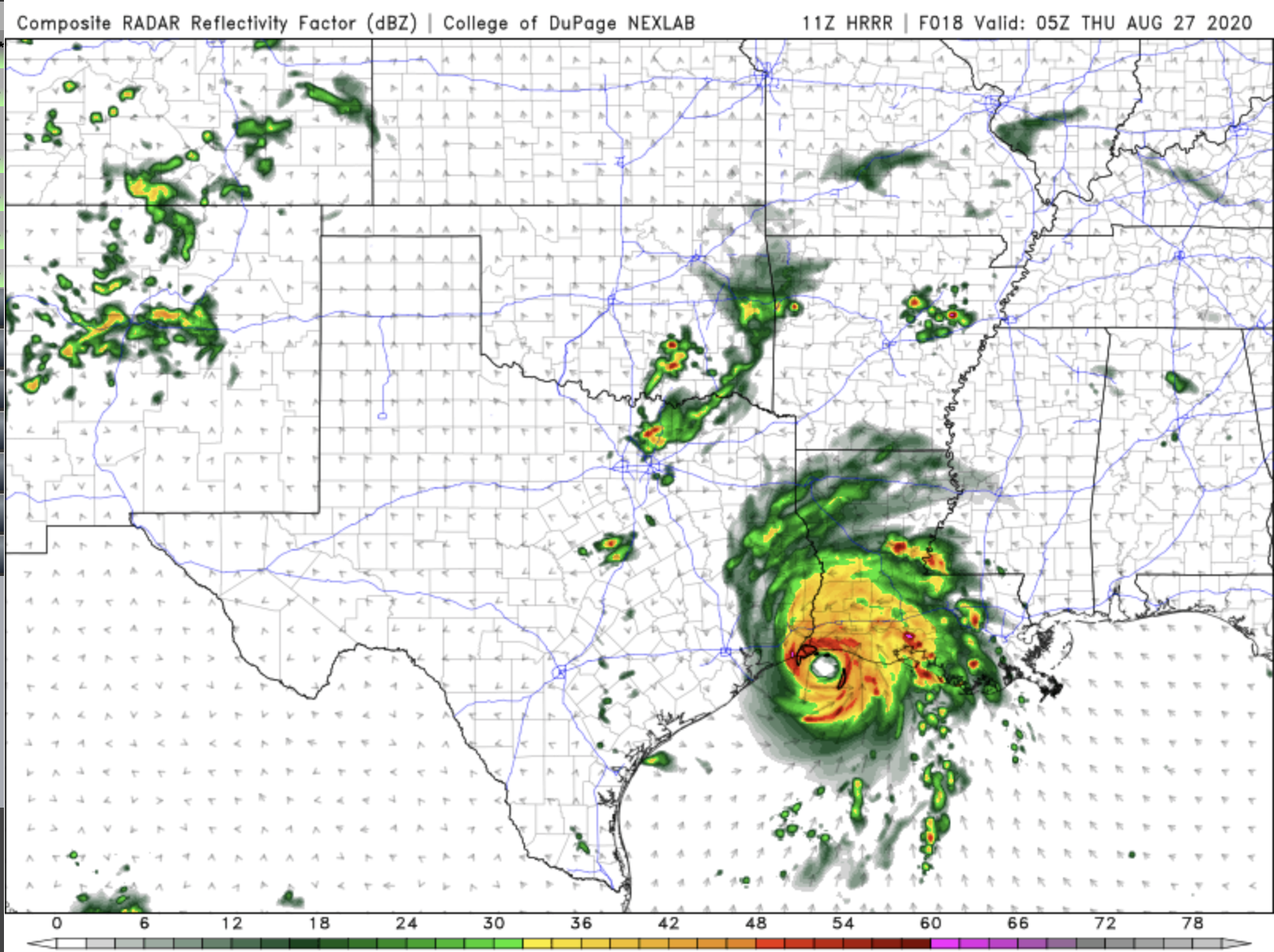
This is the HRRR for 11PM tonight. Again, the eye is just offshore, and just southeast of the mouth of the Sabine River.

And, this is the NAM for midnight tonight. In this model, Laura is coming ashore just east of the Sabine River. These three models are all telling us pretty much the same thing. We should be expecting Cat 2 hurricane force winds from up to 60 miles on either side of the Texas/Louisiana border as the storm makes landfall around midnight.
In addition to the storm surge along the coast (especially on the Louisiana side) we can expect flash flooding problems all the way up to I-20. There will also likely be tornado watches issues in most of Louisiana and parts of East Texas overnight and through about noon.
We are planning on launching the Big Bad Weather Blog this evening to keep track of this storm as it comes ashore. Make sure you like our Facebook Page so you can get the latest updates and ask us questions about the storm live tonight.