
Cristobal Makes Landfall Today

Cristobal will make landfall today south of New Orleans. The animation above is a pretty good depiction of what we’re expecting this storm to do. Notice how it makes a little jog to the left, but keeps on trucking north. Also notice most of the heavy rainfall remains on the eastern side of the storm. That’s the area that has the greatest potential for some quick spin-up tornadoes as Cristobal moves inland.

This is the official track from the National Hurricane Center. Cristobal will start to lose power as he makes landfall, and will be down to a Tropical Depression by the time he reaches North Louisiana.
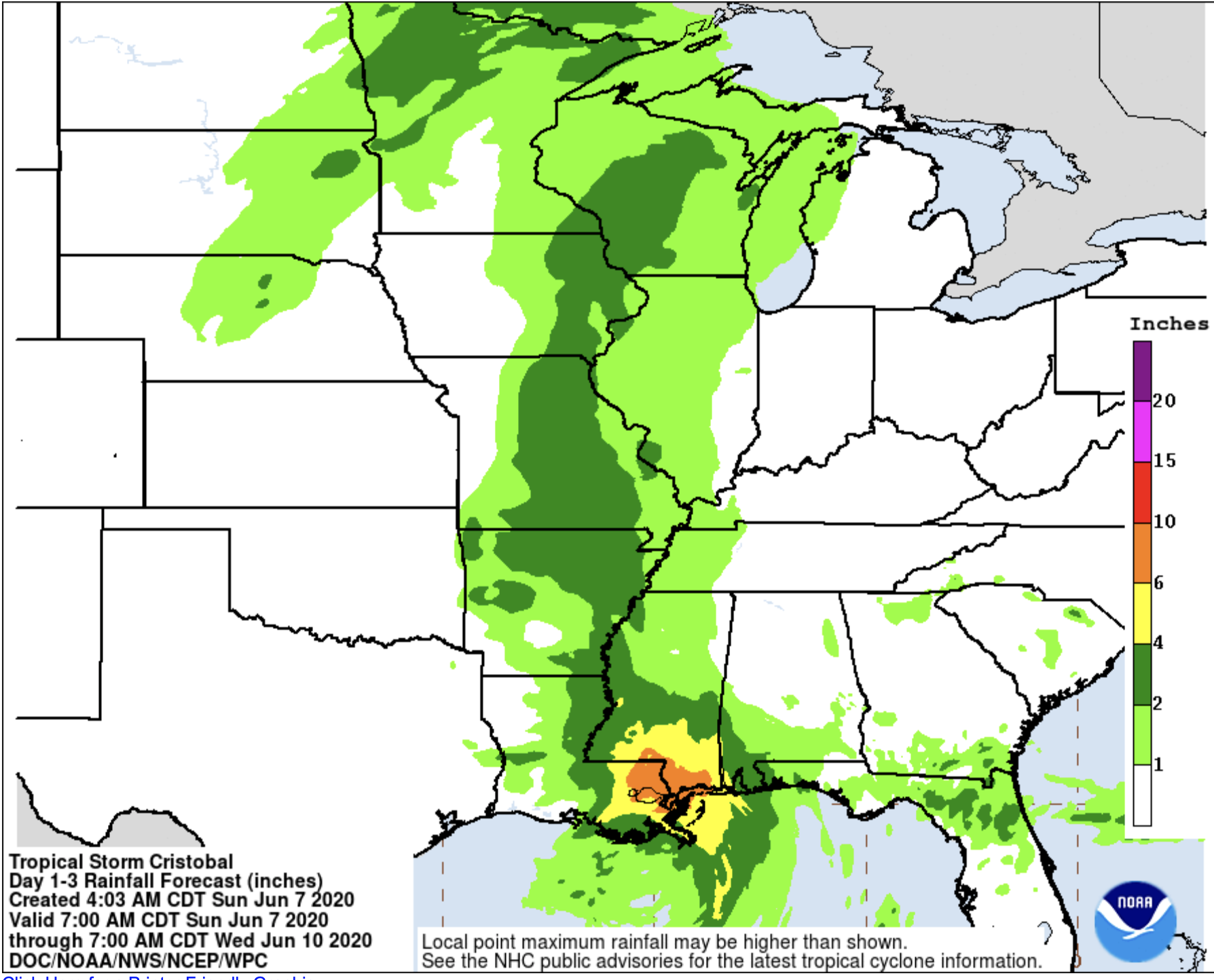
Because Cristobal is not expected to stall along the coast, the potential for flooding is much lower. The Weather Prediction Center is calling for between 6” and 10” of rain from New Orleans over to Mobile. That same area also has the potential for some storm surge flooding.
All said, this is just a Tropical Storm. We’ve seen these before and while there will be wind damage and localized flooding, we’ve certainly had worse storms in this area before. We’ll keep on top of Cristobal for you as he heads inland and if we need to launch the Big Bad Weather Blog, we will!