
A Series of Winter Storms
This is going to get complicated.
We are looking at a series of winter weather events to swing through Texas and Louisiana this weekend and into next week.
Let’s start with Thursday.
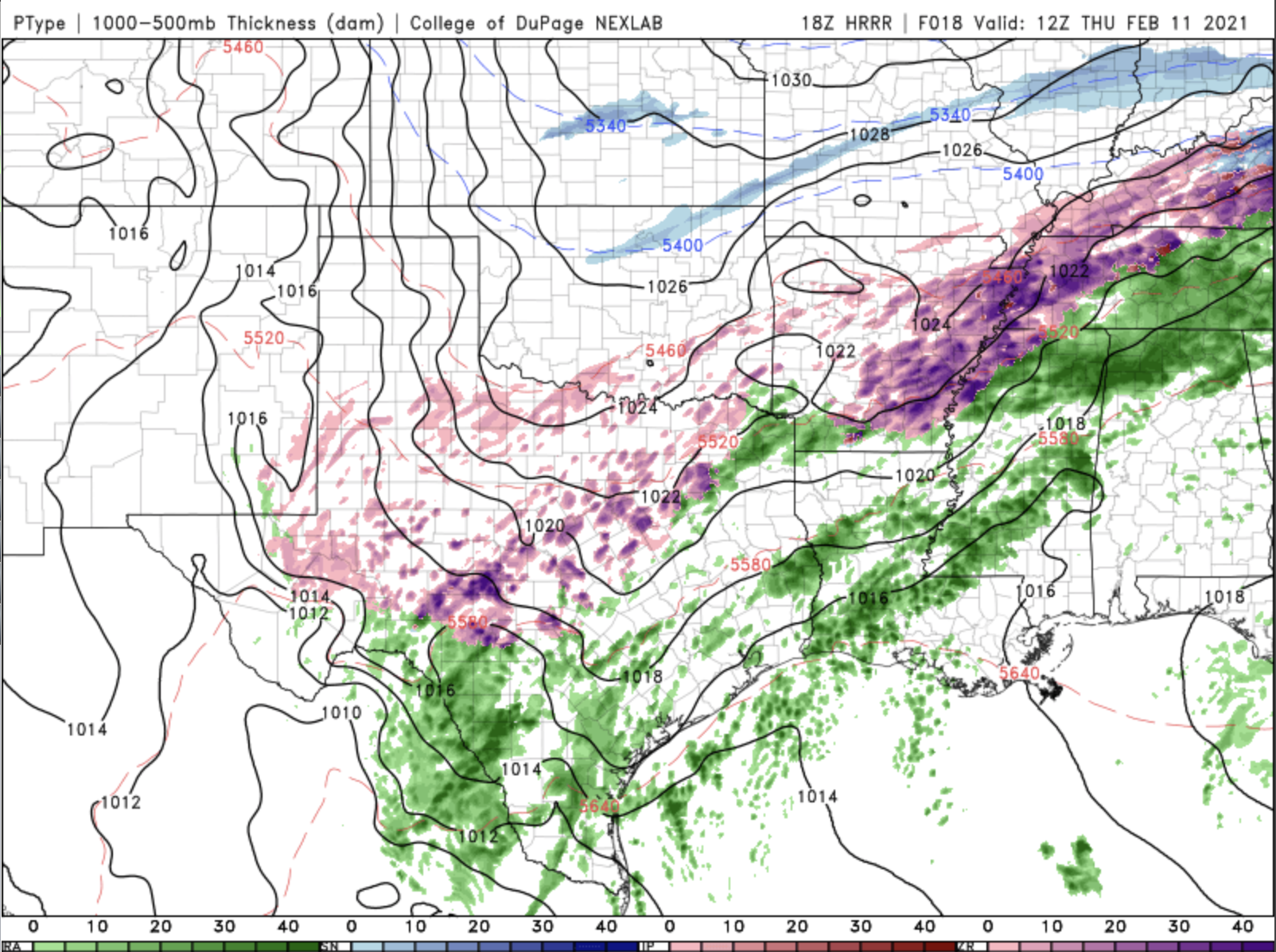
Here’s the HRRR model for Thursday morning. Notice the band of purple and pink running from West Texas up through Memphis. That’s ice/freezing rain/sleet. It’s pretty nasty. And, unfortunately, it continues most of the day on Thursday. Fortunately, most of it shouldn’t be heavy, especially the mess in West Texas.
Then, there’s Friday.

Again, there’s a wintry mess in West Texas and in the DFW area. Roads will ice. Drivers will panic. And, again, it’s going to go on most of the day. That will swing through into North Louisiana on Saturday, and slowly come to an end during the day.
The good news here, is that this doesn’t look like as much wintry weather for Friday and Saturday as we were originally seeing in the models. The bad news, is that it’s not over.
Here’s Monday.

This is the GFS model for Monday morning. Notice the band of snow from West Texas up through Tulsa and Ft. Smith. Then, there’s the wintry mix from south of San Antonio through East Texas and North Louisiana, and the band of freezing rain from Corpus Christi through Houston. All of that swings east during the day before fading out.
Now, weather models are notoriously bad in dealing with winter weather in the south, especially more than three days out. But, the normal type of set up for winter weather in Texas and Louisiana is what I call a One-Two Punch. Punch One brings in cold, freezing air all the way down to the Gulf, and the cold front that brings it stalls out into a stationary front, preventing warmer, moist air to return from the Gulf of Mexico. The second punch comes with an upper level disturbance flowing over this cold air, and that creates the snow and sleet and freezing rain. Well, that’s exactly what the models are showing, but instead of just a One-Two Punch, this system appears to have a third punch waiting to flow through on Monday.
We’ll keep you updated as we get closer!