
Gulf Coast White Christmas?
So you want to see some snow for Christmas this year, eh? I’ve been hearing a lot of rumors and a lot of excitement as people have been calling me and asking me, “is it really going to snow on Christmas in Louisiana!?” Well, I’ll give you both the fairytale answer and the more likely answer!
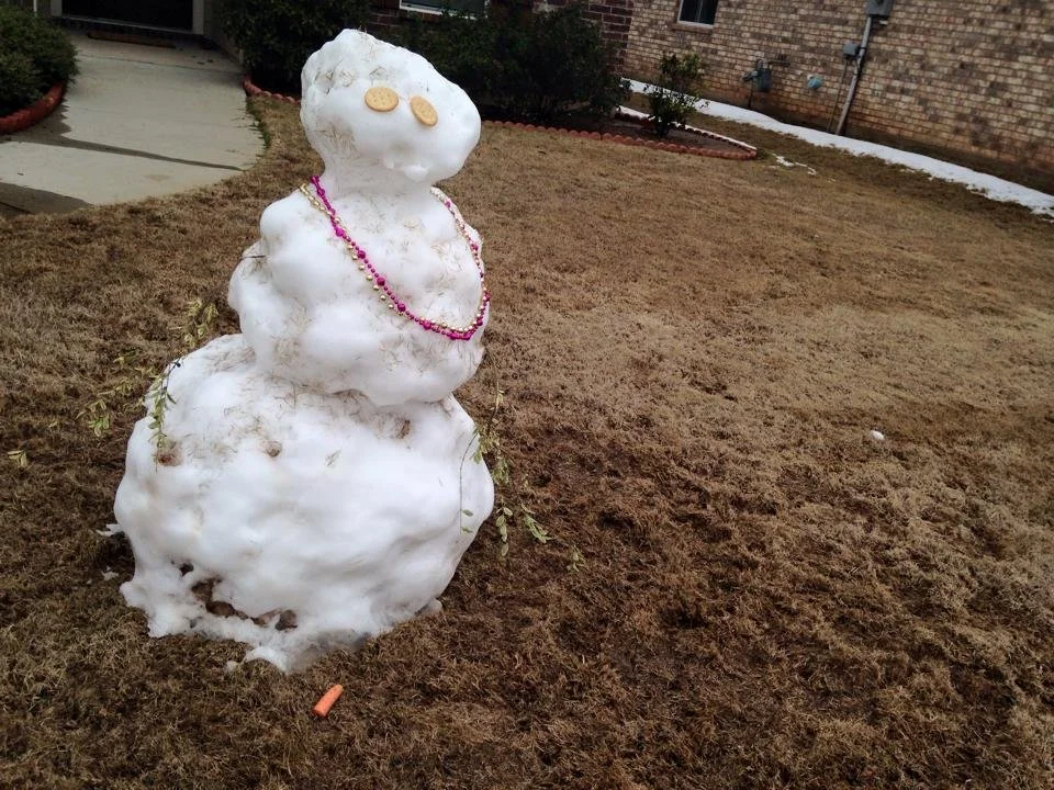
A rare Louisiana Sneauxman melts just hours after being born. Leaving behind a mixture of grass, mud, and twigs. All that will be left soon is his carrot nose, ritz cracker eyes, and Mardi Grad beads. - Feb. 25, 2015.
That poor sneauxman. Anyway, let’s talk about what we need for snow to happen and what models are showing.
WHAT WE NEED FOR A WHITE CHRISTMAS
A “White Christmas” is defined as having at least 1” of snow on the ground on Christmas Day. So will we see that this year?
In order for the atmosphere for get snow from the clouds to the ground, it needs to be at or below 32 degrees in the clouds and below the clouds long enough for snow to form and reach the ground. Surface temperatures don’t have to be at 32, but it certainly helps, and if surface temps are above freezing then getting it to stick is pretty tough.
GFS MODEL: The snow lover’s dream come true
The GFS Model is the one that has everybody all hyped up about the chance of this happening. It’s the one picture you’ve probably seen shared around a bunch of times. It’s also the model that thought it would be over 100 degrees every day this summer and nearly never verified. So take that for what it’s worth. So what does it show?

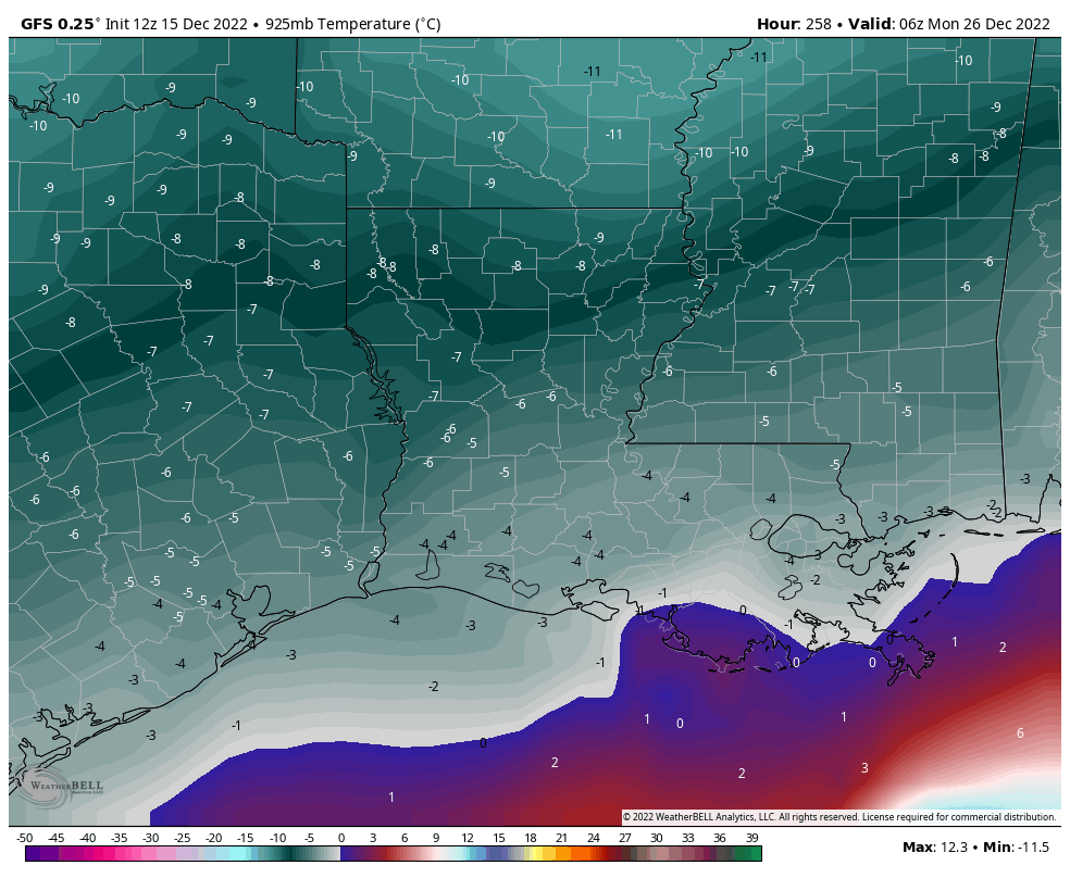
12z GFS 12-15-22
Is it cold enough to snow at cloud level? Yes, but marginally. You can see a spots where cloud level temperatures might be around 33 or 34 degrees. (0 on this map is 32 degrees)
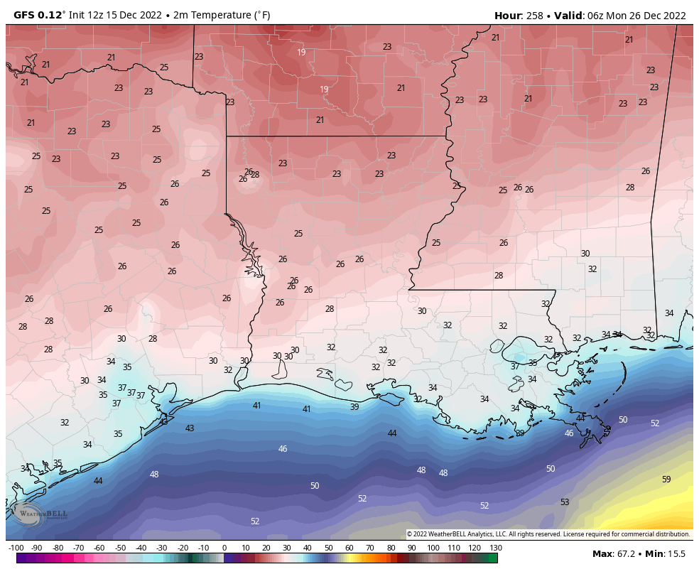
12z GFS 12-15-22
Is it cold enough to get that snow out of the clouds and to the ground? Yes! Temperatures below the clouds look to be able to sustain snowflakes. Again, we’re in celsius here. So anything below 0 is below freezing.
12z GFS 12-15-22
It is cold enough for snow to stick? In some areas, yes!
REALLY? SO HOW MUCH?!
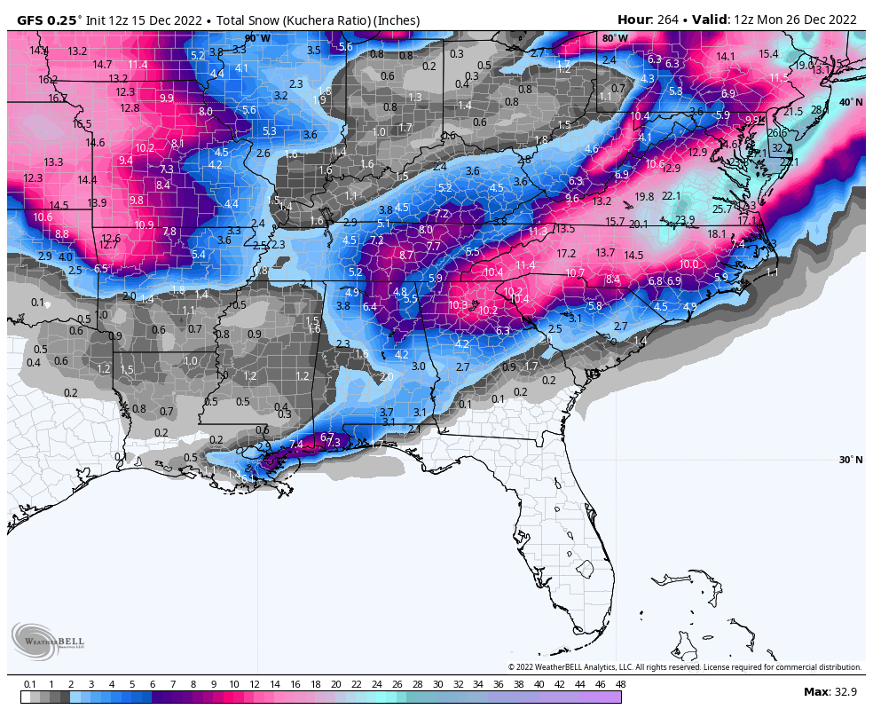
12z GFSF 12-15-22: Holy Cow, Batman! It’s going to SNOW!
BUT IS IT….???
Well, it looks like it’s all there, right? Here’s some cold hard facts about snow and the rarity of a White Christmas for South Louisiana.
Reliable records have been kept for New Orleans since about the mid 1800s and in that time there have only been 17 measurable snows and 2 times where it snowed on Christmas (1953 and 2004). 1953 was only a trace of snow so it didn’t technically count as a “White Christmas.” Now remember, we’re talking about snow, not sleet or freezing rain, only snow.
REALITY CHECK
The GFS can be modified and when it is, it’s called the GEFS (the E stands for Ensembles). There are 21 different tweaks made to the GFS to account for uncertainty in the forecast output. From those 21 members, we can figure out the probability of this snow actually coming true. The GFS obviously has everyone excited about this possibility, and it is just that, a possibility, but what does this same model show is the actual chance of this happening?
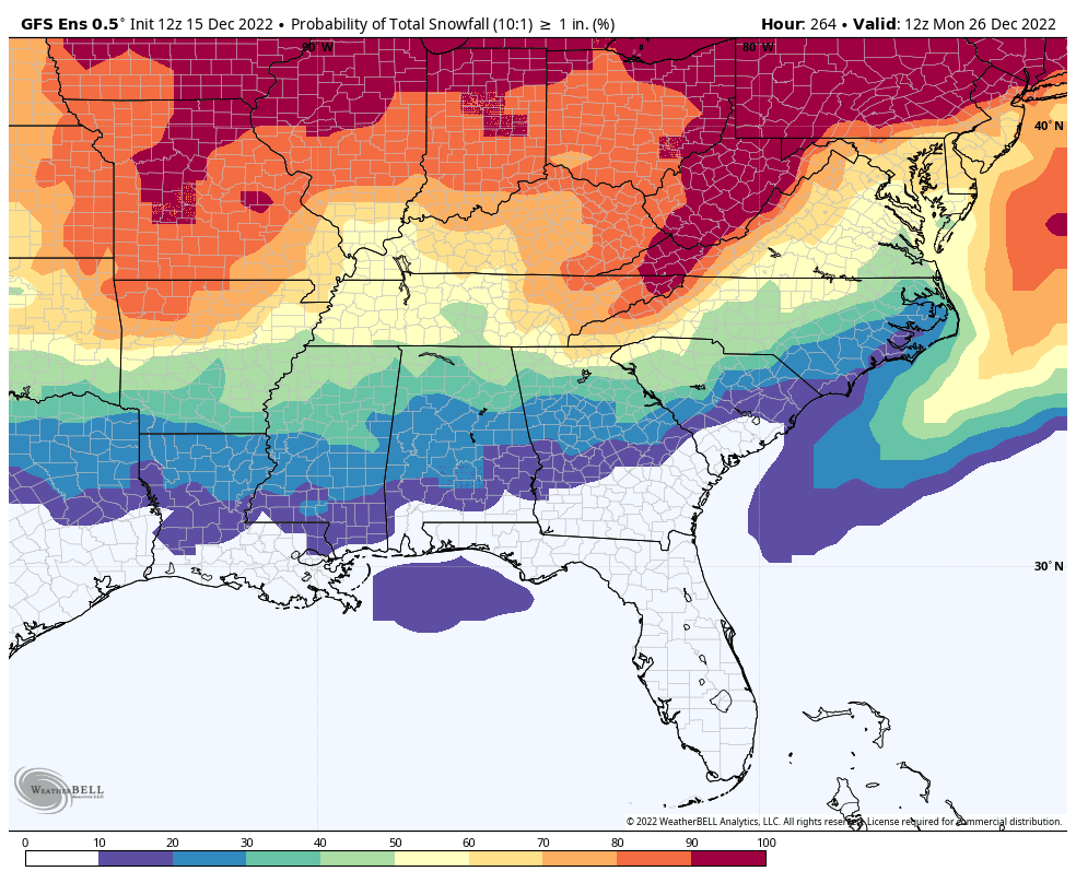
12z GEFS 12-15-22
The same model run that shows more than 5” of snow falling across South Louisiana and Mississippi on Christmas evening shows less than a 10% chance of 1” of snow actually falling.
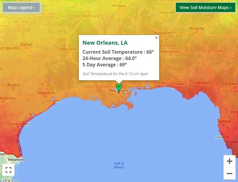
Soil Temperatures
Another limiting factor of snow accumulations is the very warm ground temperatures. Warm ground means it’s hard for snow to stick around before melting. With soil temperatures averaging in the 60s, it’s safe to say the chances are pretty low.
Now, it’s important to understand that this whole situation is fluid. It could snow or it could not snow. I’d say the chances of it not snowing are higher, but there’s still a non-zero chance of snow happening on Christmas Day. The overall pattern favors cold temperatures and a developing low across the Gulf. So we’ll see if the ingredients come together or if we’ll end up with a cold rain. “I’m….dreamin’…of a white….Christmas!”
NOTE: The EURO Model is not within range on this potential event yet. We’ll see if we gain or lose confidence once the EURO is within range.