
Watching the tropics…already?

It’s true! We’re watching a system for tropical development for the weekend.
The official start of hurricane season is still a few weeks away on June 1st. The thing is hurricanes don’t care about the calendar as long as the conditions are right.
Here’s the scoop, we don’t think this system will threaten the U.S. coast, but it may cause some maritime issues in the Atlantic.

The National Hurricane Center gives the system a 70% chance of development into a tropical system over the next 5 days. The next 48 hours is at 0%.
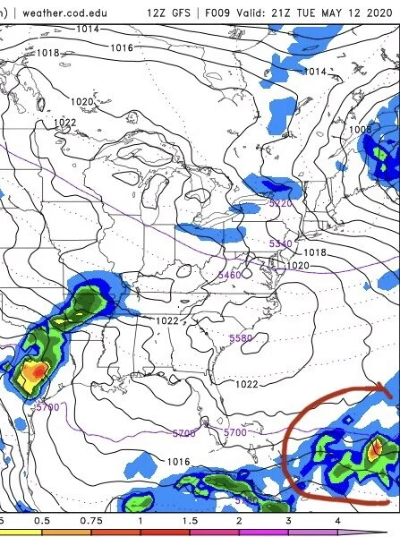
Here’s what the system looks like today. It’s really just a cluster of showers and storms out over the open waters of the Atlantic Ocean.
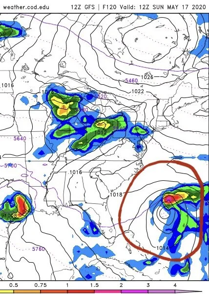
By Sunday morning, it looks a lot more like a tropical system per the GFS model, but it’s still a ways away from any land. It’s likely this system would become a “sub-tropical” depression or storm. Which basically is a big fancy way of saying, it has winds like a tropical storm (40mph - 70mph) but it lacks certain characteristics to be called a true “tropical” storm. It’s really just a scientific label thing. It doesn’t lessen or worsen impacts. Generally, “sub-tropical” systems won’t develop much stronger than a “sub-tropical storm.” If it does, then it’s just labeled a hurricane.
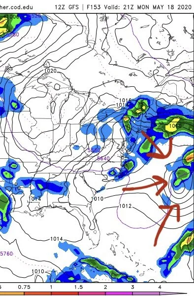
By Monday afternoon, you can barely see our possible sub-tropical system on the map. It will continue to gain speed as it marches off to the NE over the Atlantic.
So we’ll be watching! Of course, this is only one model we’ve shown here, but we don’t think you need to stress about this one just yet.
By the way, we are working on our own 2020 Atlantic Hurricane Season Outlook. Be looking for updates on that in the coming weeks.