
Strong cold front with some storms

What radar may look like 6:00 am Friday
We’re still tracking a strong cold front set to swing through the south on Friday.
While there will be some heavy rain and storms along the front, there is a very small chance of Big Bad storms with this system. So most people will see some good old fashioned thunderstorms.

What radar may look like 9:00 am Friday
Rain and storms, most of them below severe limits, will move through from Texarkana to Shreveport and Dallas during the morning hours on Friday.
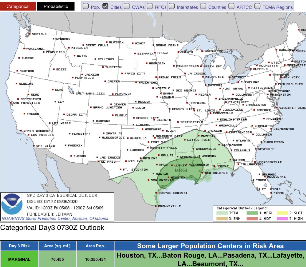
The low end Big Bad storms threat will mainly be south of I-20 during the afternoon hours on Friday. Some hail and perhaps some damaging winds will be the main threat, but again this should be rather isolated. This will impact the New Orleans/Baton Rouge areas later in the evening.

What radar may look like 7:00 pm Friday
An added bonus to this system is a cool down. Temperatures will range mainly in the 40s and 50s on Saturday morning. Followed up with mild highs in the 60s and 70s.

Approximate temperatures 7:00 am Saturday