
Mild with rain in the South; Coastal rain/mountain snow for much of the West
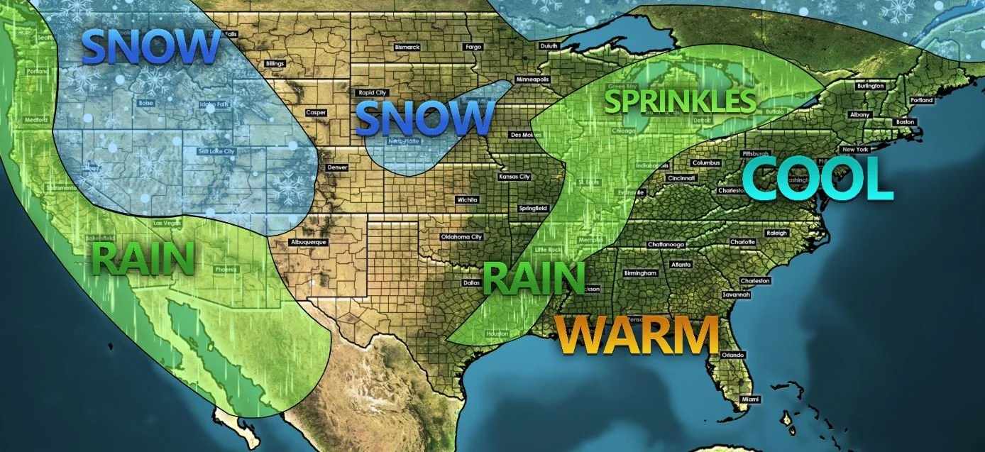
After the deep freeze, most of the country is thawing this week. That’s especially true for people living in the Deep South, Texas, and Florida. Another round of coastal rains and mountain snows will push onshore in the west today and tonight. Showers and storms are developing across Louisiana.
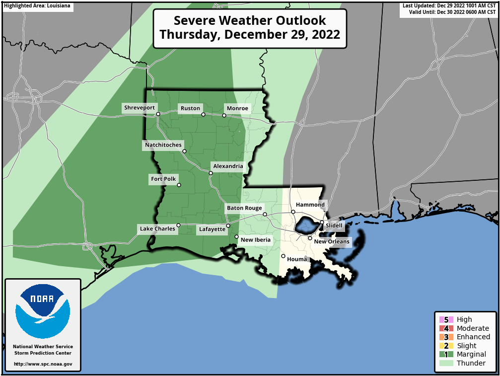

LOUISIANA
Radar out of Shreveport shows ongoing showers and embedded thunderstorms moving from SW to NE across East Texas and Louisiana. The Storm Prediction Center has the area highlighted in a Marginal Risk (1 out of 5) for a few stronger storms today. There’s a small chance of a tornado, hail, and wind, but I think the more likely threat today and tonight will be the chance of flash flooding from heavy rain.

Rainfall totals through Saturday morning
The HRRR Model shows heavy rain continuing across NW LA into NE LA overnight and into Friday. Anywhere from 2 - 4” of rain could fall with locally higher amounts possible. The rain will push east into MS Friday.
WARMING UP
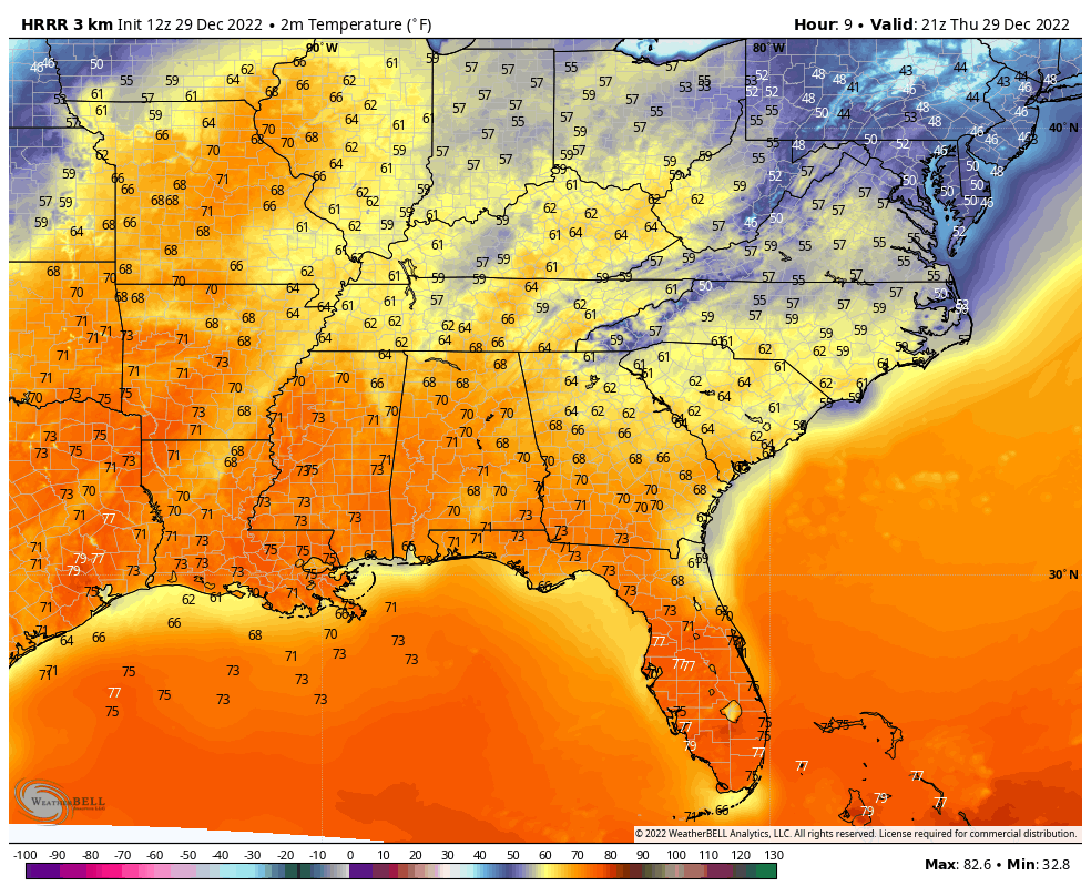
Despite the rain, much of the Southeast and even up into Missouri will be pretty warm over the next few days. That’s one reason a few of these storms today could become strong to severe across Louisiana. This warmth is welcomed with open arms after last weekend’s major Arctic front.
PACIFIC NORTHWEST AND WEST COAST
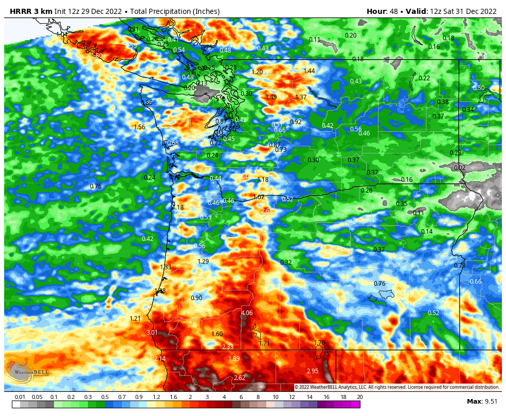
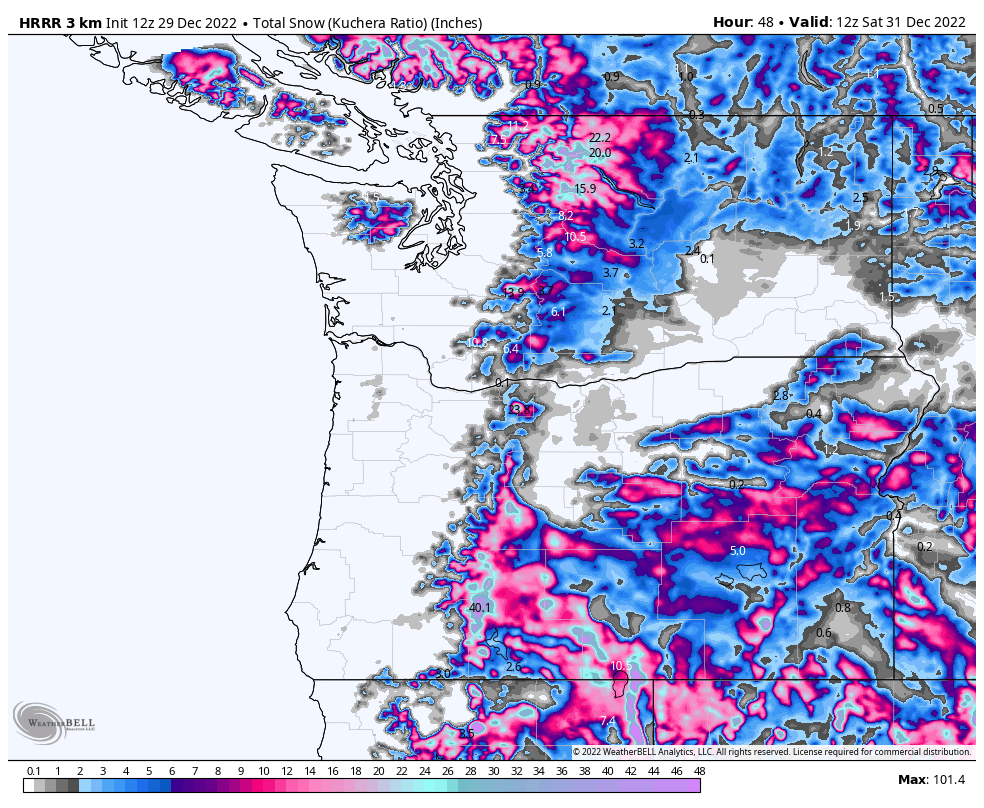
It has rained a lot recently along the West Coast of Washington, Oregon and California, and we’re going to see more of that later today and into the night. This will also translate into several inches to feet more snow in the mountains. All good news for local ski resorts in the area, but rather gloomy conditions for the folks living at lower elevations.