
Southeast Storms; Feet of snow for California
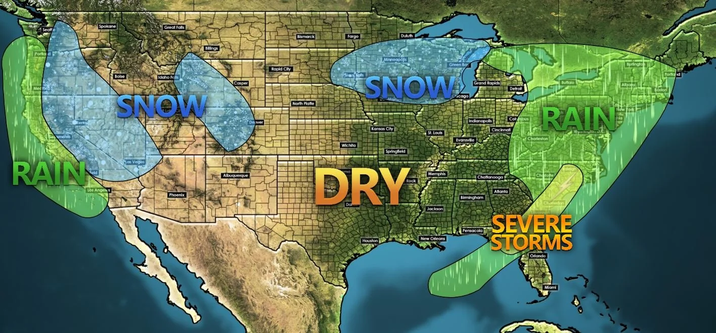
The middle section of the country is seeing a few dry and quiet days aside from some snow showers for Nebraska, South Dakota, and the Great Lakes Region. Storms are rumbling across the Southeast and yet another strong system is bringing rain to the West Coast and heavy snow to the mountains.
Southeast Severe Threat
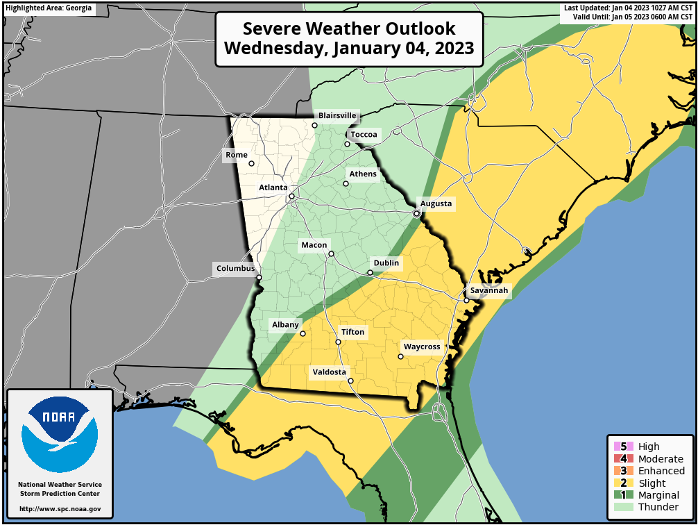
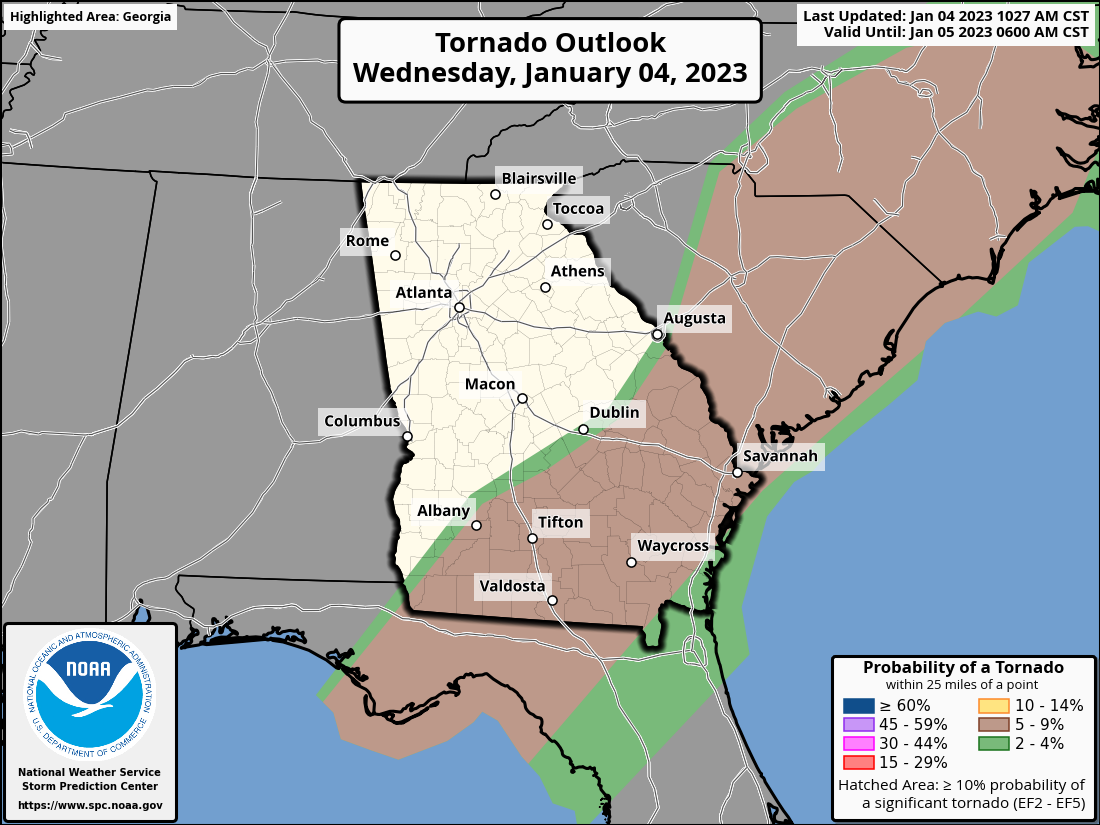
The system that has continually produced severe weather across much of the southern states is making its last day of impacts along the East Coast. Today the threat extends from Florida to coastal North Carolina. The main threat will be some damaging wind gusts, but a tornado or two can’t be ruled out. These storms should mostly push off the coast by 5pm or 6pm this evening.
Radar near Moody AFB, GA

Radar near Charleston, SC

California Rain and Snow
For the last several days, the West Coast from Washington to California has seen a lot of rain and snow, and we will add to those totals in a dramatic fashion over the next 7 days. You’ve likely seen the term “atmospheric river” being thrown around a lot recently. All that means is that storm after storm is riding on the jet stream over the Pacific Ocean and straight into the West Coast.
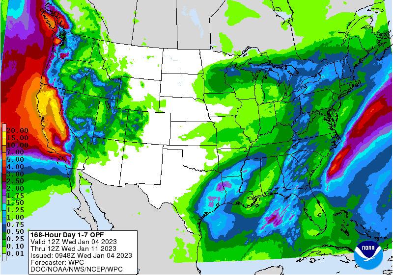
Weather Prediction Center’s Rainfall Forecast
This is a look at the projected rainfall totals over the next 7 days. Notice how California lights up in yellows. That’s 15+” of rain! No doubt these areas need moisture, but that’s too much at once and flash flooding is a concern.
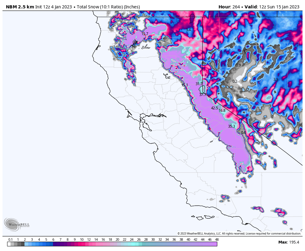
National Blend of Models
We mentioned 15” of rain, but what does that mean for snow. The general rule of thumb is for every 1” of rain 10” of snow will fall. Do that math! That’s ~150” of snow in the California mountains over the next 7 days. The model image shown to the right shows max amounts of 195” of snow! Again, great moisture source, but way too much snow all at once. What for avalanche conditions and some areas may be completely cut off until roads can be cleared.
Above Average Temperatures
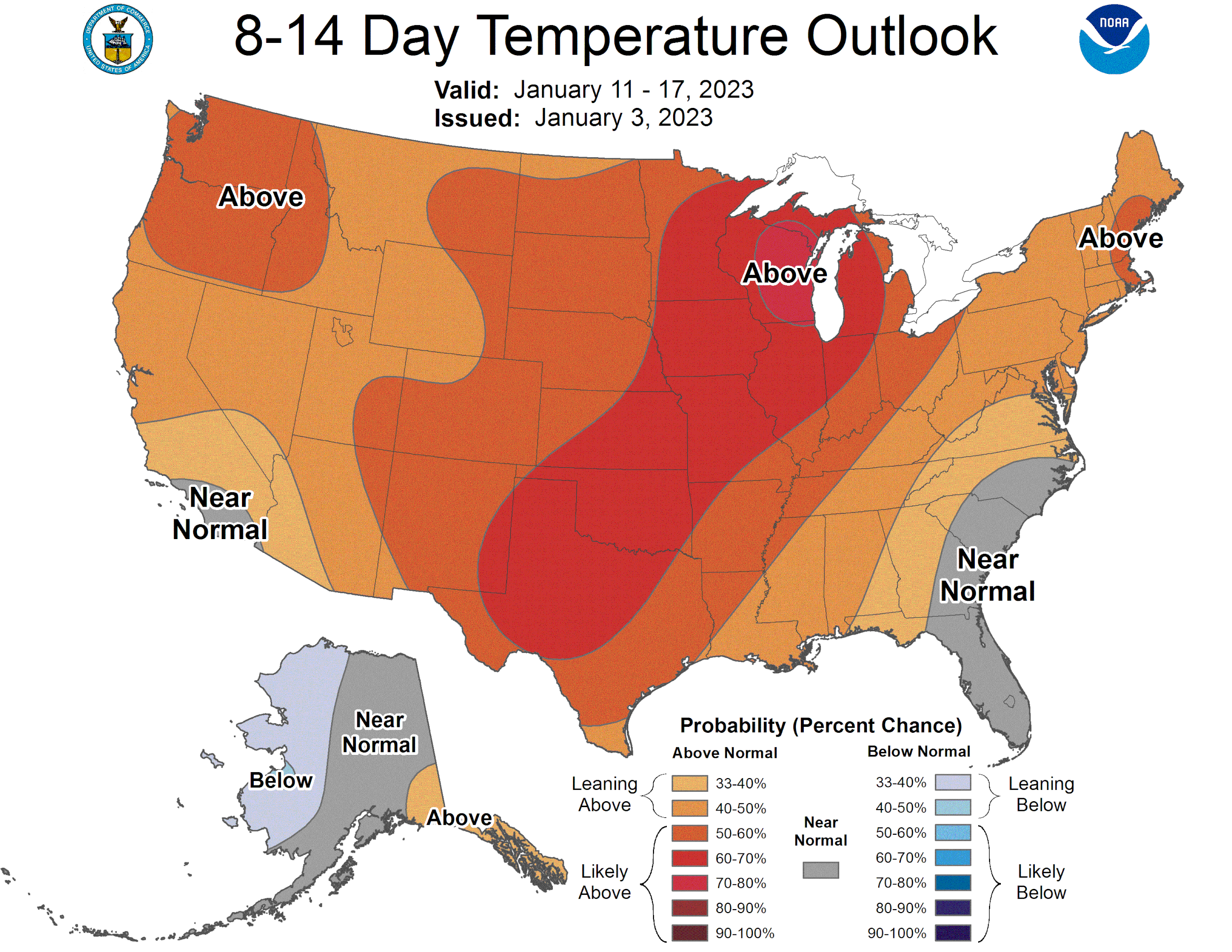
Aside from those two systems bringing impacts to the East and West Coasts, the middle part of the country is getting a few quiet days to reset. All the while, also enjoying some above average temperatures following the big cold snaps from Christmas week.
Follow us on Facebook: https://www.facebook.com/StormGuides
Help us reach more people: https://stormguides.live/donate
Need a personalized forecast for an upcoming event or trip? We can help you make better plans!
Email us: https://stormguides.live/contact