
Lovely Winter Weekend
OK, maybe not so lovely. Yes, Valentine’s Day is coming, but so is a wintry mix, and frankly, more of a wintry mess in many areas.
What’s more, it’s not just one pass. We’re getting several winter storms over the next 6 days.

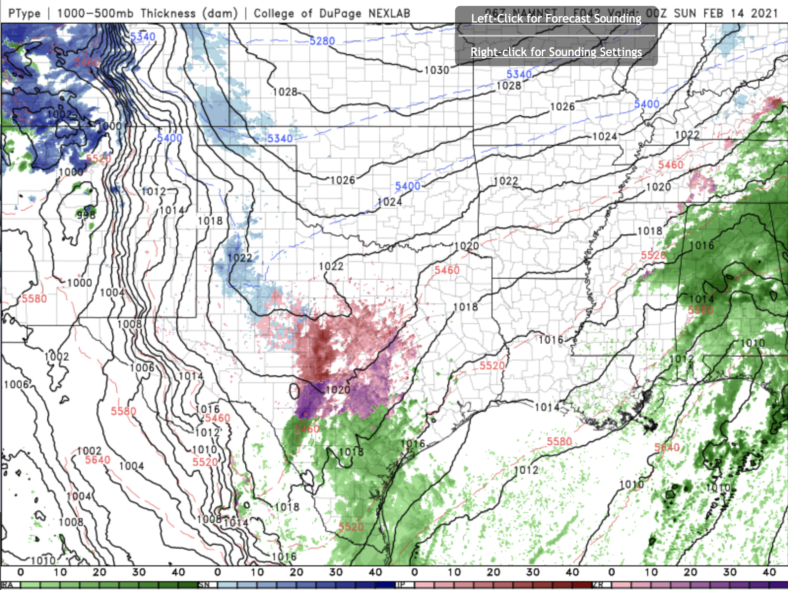
This is from the NAM-Nest model for Saturday morning. Notice the on-going wintery mix in West Texas. That’s sleet, ice, and some snow mixed it. It’s not a lot of accumulation, but it’s enough to make driving dangerous. That transitions over into cold rain in South Texas and the Valley.
In Louisiana, most of the precipitation is a cold rain. However, there is a chance for freezing rain in Central Louisiana over into Mississippi.
By Saturday afternoon, most of the rain has moved out of Louisiana, and the wintery mix in West Texas has moved into the Hill Country. That means you need to avoid driving anywhere along I-35 between San Antonio and Waxahachie tomorrow. It’s going to be bad, and folks who live in this part of the country really don’t know how to drive in this. It’s going to be a mess.
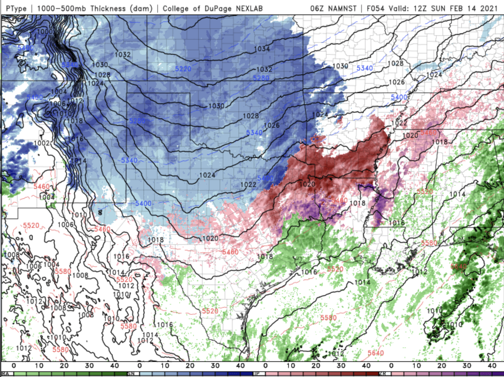
And, then it really gets going. This is Sunday morning. We have light rain in the Valley, and in Southeast Texas and Southwest Louisiana. Everywhere else, it’s winter.
The Texas Panhandle, and all of Oklahoma will get snow, and it could be several inches of accumulation. Snow is better than sleet or freezing rain when it comes to driving conditions, so for folks in those area, enjoy the weather! It should be beautiful.
But, from Central Texas up into Texarkana and over to Memphis, it’s a mess. We’re looking at sleet, freezing rain and snow mixed together. Just as people need to stay off the roads in the Texas Hill country on Saturday, they also need to stay off I-20 and I-30 on Sunday.

We’re now looking at the GFS model output for Monday morning. Fortunately, it’s President’s Day and most schools aren’t in session. Notice the ice and sleet has moved to the Texas Gulf Coast. This winter weather will be falling from Corpus Christi, through Houston and Beaumont, into Lake Charles, and up to Monroe in Northeast Louisiana. There is a transition over into snow for Northeast Texas and most of Arkansas. Shreveport and Bossier is a little bit tougher. It’s likely to start off as a freezing rain/sleet mix and then transition into a snowfall event. Again, for the areas that do get snow, it’s looking like it’s going to be a lot. 6” or more is many locations.
But, we’re not done just yet.

This is Wednesday evening, according to the GFS. Once again, there’s a nasty wintry mix from Austin to Shreveport, to Little Rock and even up to Memphis. Now, this is a little far out, and models don’t do a great job of being this specific and still remain accurate with wintery weather, but the concept is right. There will be another upper level disturbance coming over Texas and Louisiana, and it will still be cold - colder than it’s been in many places in decades. So, we’ll keep watching it for you and share what we see to keep you prepared.