
Valentines Day Winter Weather
Valentines day is going to be a mess for much of the South. Let’s take a look at what’s going to happen, starting with Sunday evening.

We’ll start with surface Temperatures. The models are showing most of Texas and Louisiana will be below freezing by the afternoon. Everywhere north will also be below freezing. The only surface locations that will be above freezing will be South Texas, along the Gulf Coast, and Southeast Louisiana. So, anything that falls in these areas will be frozen. Snow that falls will stay snow and stick and accumulate. But, any rain that falls in these areas will freeze, especially on elevated surfaces like overpasses, power lines and tree limbs.
So, the key to really understanding the threats from this storm is to see where things will fall as snow and where they will be falling as rain.

This is a zoomed in map of the 850mb from the NAM model for Sunday afternoon. This is showing us temperatures about a mile up in the atmosphere. The blues and purples are below freezing. But, the greens are above freezing. Also, notice the wind barbs. It’s showing us that about 1 mile above the surface, the winds in East Texas and Louisiana are coming out of the Gulf of Mexico, and keeping temperatures there above freezing. So, any precipitation that falls in those areas on Sunday will start off higher up in the atmosphere as snow flakes, fall into this part of the atmosphere, and melt into water, then hit the ground and refreeze. That’s not good.
Here’s out this plays out in the precipitation map…

Notice the rain along the Texas Gulf Coast. Then, that transitions into the purple wintry mix from the northern suburbs of Houston over to San Antonio, up to Austin, and then running diagonally through Tyler, Shreveport, southern Arkansas, and Northeast Mississippi. Further north, where the temperatures a mile up remain below freezing, it’s all snow.
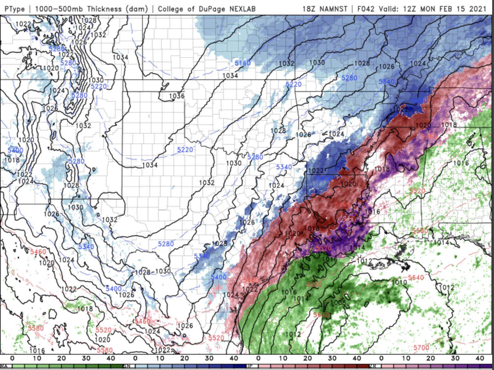
By Monday morning, the wintery mix has spread over into Corpus Christi, Houston, Beaumont, and South Central Louisiana, including Lafayette and Baton Rogue. The line of snow moves down to San Antonio and up through Shreveport and Little Rock.
This is just the first pass. We’re still looking for more winter weather to come through this area again midweek. The general rule for all of these areas, is if you can, don’t leave home. Most people who live in this part of the country have no idea on how to drive in this type of weather, and that makes travel more dangerous for anyone else out on the roads. You need to be prepared to lose power, especially in the places that are looking at the threat of freezing rain. And, don’t expect for this to clear up quickly. We stay below freezing in most of these areas until at least Thursday afternoon.