
Watching Laura and TD 14

Two tropical systems in The Gulf this weekend? It’s possible, but here’s why we’re not panicking yet.
Let’s first look at new named Tropical Storm Laura. At the 2pm update, she was moving west at 18mph, winds sustained at 45mph, and pressure at 1007 mb. That’s really no different from the earlier update. The real kicker today was a shift southward with the placement and track of the storm.

2pm NHC Advisory
The latest forecast track puts several islands in Laura’s way this weekend. Many of these islands have big mountains that can disrupt Laura’s structure and circulation. We see it, and models see it. Laura’s going to have trouble holding together if she can’t get around these islands and stay over water.

2pm NHC Advisory
TD 14 remains rather disorganized as it nears the Yucatán. If TD 14 can organize, it would be named Marco. Again, land interaction could mean trouble for the weak system. Plus, dry air and some wind shear continues to hold it back.
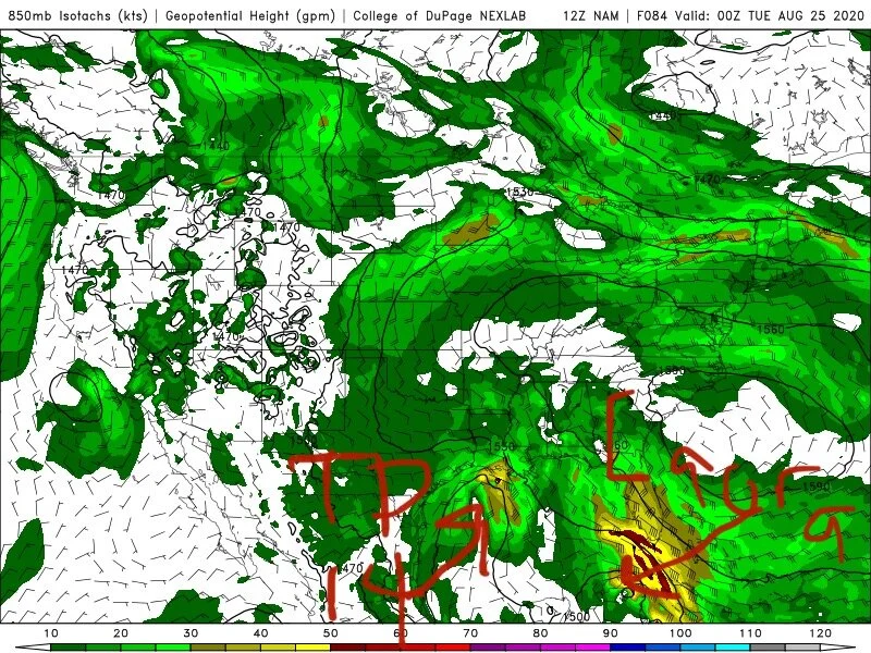
12z NAM
The 12z GFS and NAM both show Laura being next to nothing by the time she gets to The Gulf early next week. The 00z EURO is also onboard with this thinking.
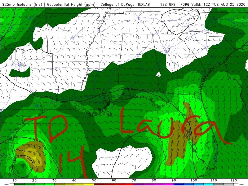
12z GFS
We’re not saying to let your guard down! It’s been a long time since meteorologists have tracked two tropical systems in the Gulf of Mexico at the same time. We understand the excitement and the worry, but that’s not what we’re here to do. We want to give you the most realistic forecast we can without the hype so we can better guide you through those concerns. Be watching for future updates!