
Weather Update - Dec. 9th, 2022
Happy Friday! Today’s weather features another storm system moving into the Pacific NW, very foggy conditions along the Gulf Coast, some wintry mix in the Midwest, and some rain that develops in OK & AR this evening.
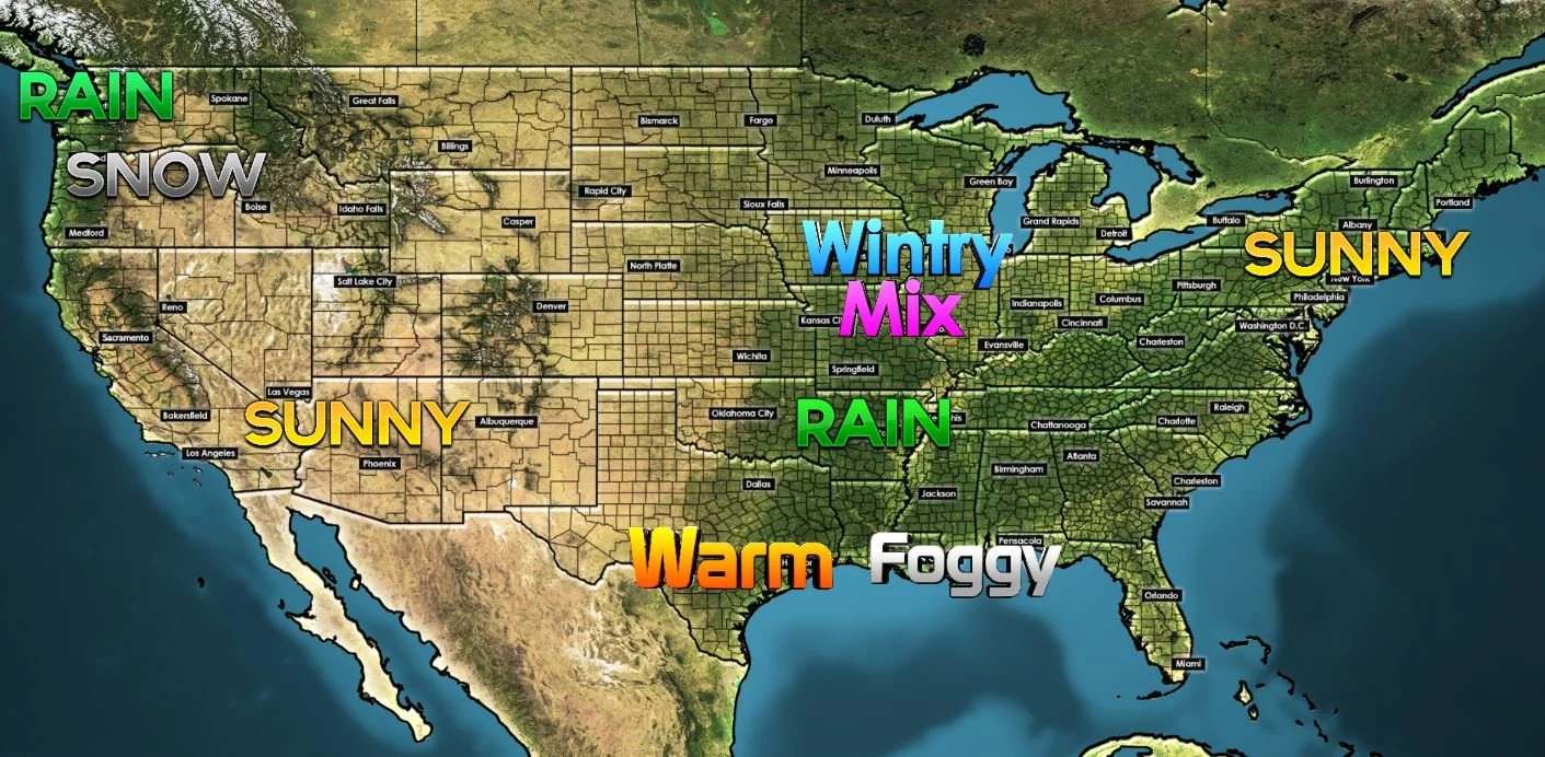
GULF COAST AND THE SOUTH:
Once the fog burns off today, it’ll be rather nice with just a few clouds. The mild to warm conditions will continue this afternoon with highs mostly in the 60s and 70s.
We are watching for some showers and perhaps a few thunderstorms to develop across Oklahoma and spread into Arkansas this evening. That likely happens later tonight and will continue into Saturday.
NORTHEAST:
Not too bad up here! It’s chilly, but not terribly cold with a lot of highs in the 30s and 40s. Thank you, sunshine!
MIDWEST:
Watch the I-80 corridor of Iowa and Illinois today. Also be watching into southern Wisconsin for a wintry mix of sleet and snow. This will include the Chicago Metro Area. Sleet looks to be mainly south of the WI stateline, while the snow will be north.
SOUTHWEST:
Much like the Northeast, sunshine dominates the forecast today with relatively chilly temperatures across the board.
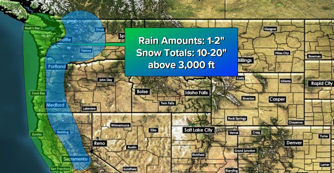
PACIFIC NORTHWEST:
Here’s where we need to talk about a big system coming ashore today. Coastal rain showers from Northern California all the way through Washington may bring some rainfall totals between 1-2” over the next 24 hours. This will translate to big mountain snows. Elevations above 3,000 feet may see as much as 10 -20” of snow over the next 24 hours. Winter Storm Warnings are in effect for the mountains from California to the Canadian Border.
Have a good one!