
A multi-day severe weather outbreak starts today
A very strong storm system has kick started the 2021 spring severe weather season and will bring widespread big, bad storms over the next 3 days.
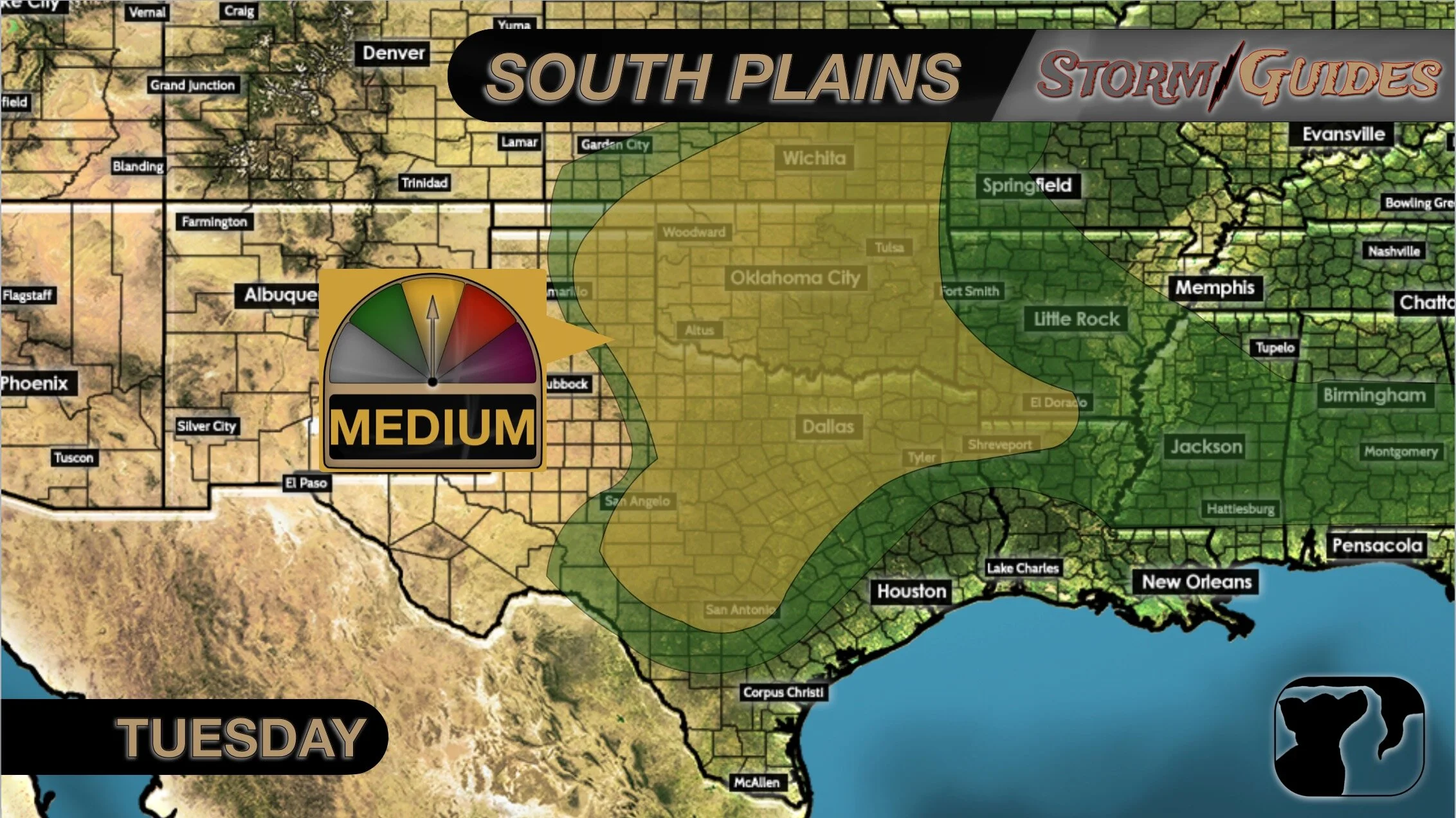
This afternoon and evening, storms will fire up across the southern plains. We’re especially concerned with the NW corner of Oklahoma into adjacent Kansas. The biggest threat will be for large hail, but a few tornadoes are still possible from Oklahoma City to Dallas to Shreveport, LA and even Jackson, MS by morning.
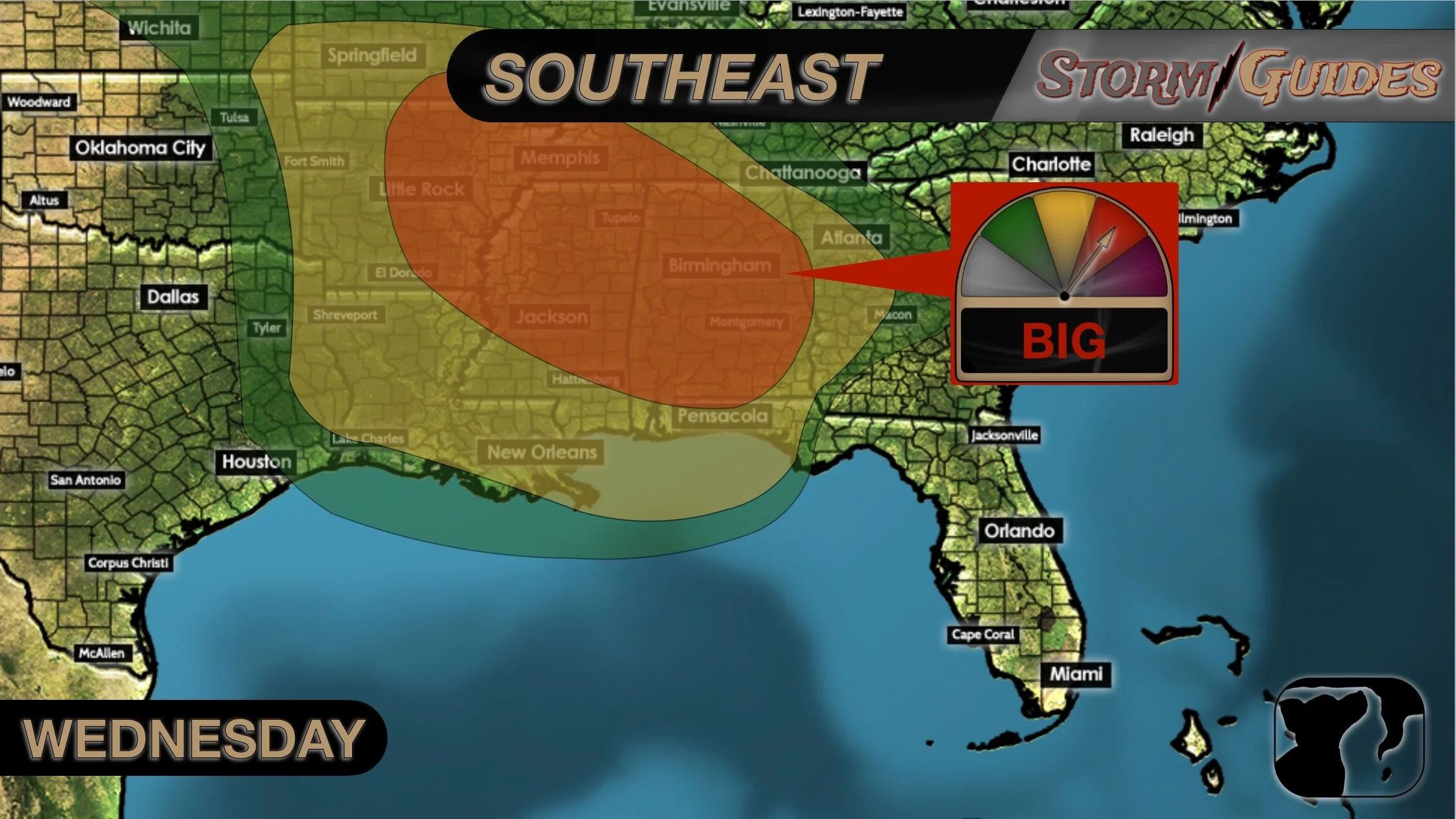
Wednesday will bring a big threat for severe weather, including the chance for several tornadoes. The highest chance for the worst of the weather is from Little Rock, AR to Ruston, LA to Memphis, TN, and Jackson, MS. This threat will also include a large portion of Alabama. If you live in this area, you should make immediate preparations for severe weather Wednesday.
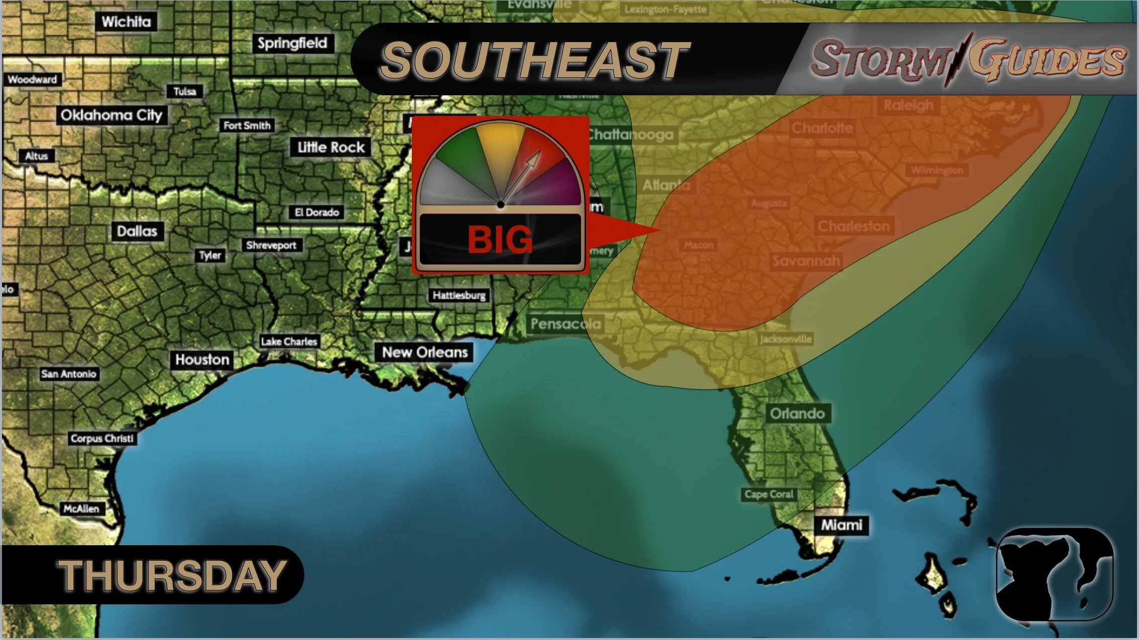
The threat will shift east on Thursday to affect the East Coast. The highest chance for severe weather will be from the Florida/Georgia line to Atlanta, nearly all of South Carolina, to Charlotte, and up to Virginia Beach, VA. Once again, there could be several tornadoes that develop with these storms.

In summary, big, bad storms are expected this afternoon through Thursday evening. The worst of the weather is expected to develop Wednesday afternoon and persist overnight for Arkansas, Louisiana, Tennessee, Mississippi, and Alabama.