
Active weather expected again this week

Monday’s Severe Outlook
Another busy stretch of weather starts Monday afternoon across a portion of Oklahoma and into North Texas.

HRRR Model at 2pm
Storms will initially fire up in the Texas panhandle around 1:00 - 2:00pm today and may pose a higher chance for large hail as they grow. These storms will eventually merge into 2 or 3 different lines of storms that will bring a straight line wind threat and even a tornado threat. Hail will still be a threat, but not as much as earlier in the afternoon.

HRRR Model at 9pm
We expect these storms to reach Oklahoma City between 6pm and 8pm and Dallas-Fort Worth between 7pm and 10pm.
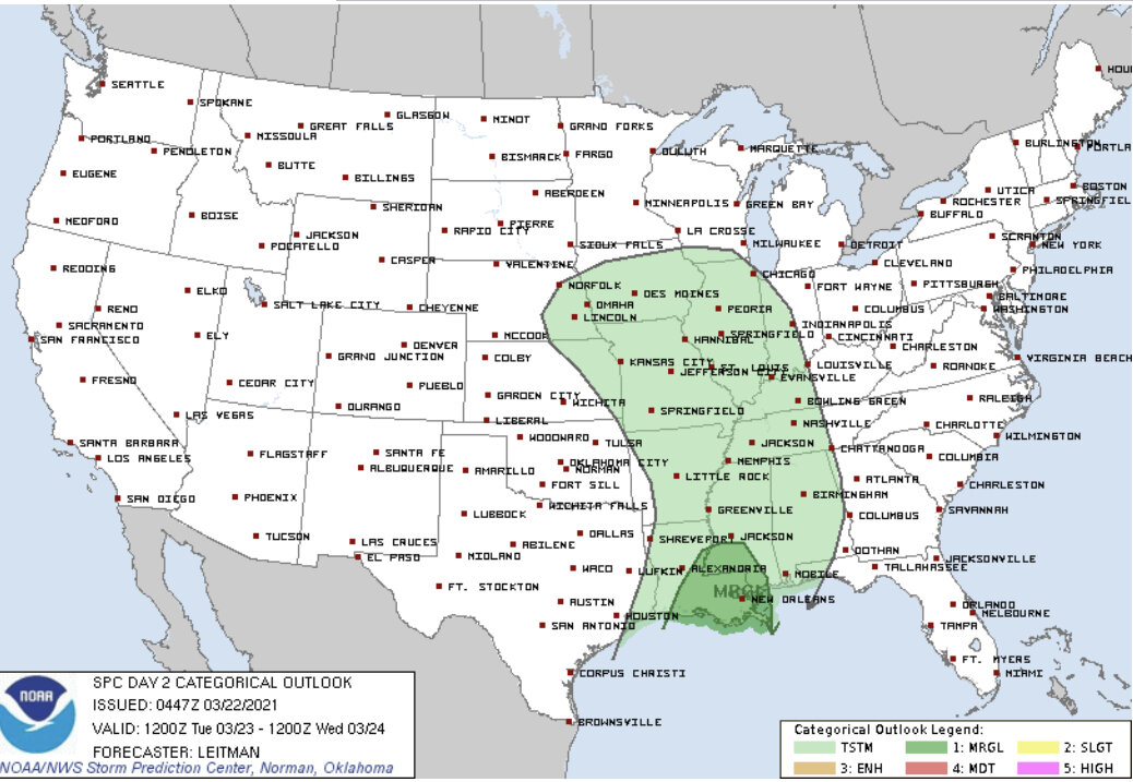
Tuesday’s Severe Outlook
A low end threat for severe weather then shifts east into Tuesday and Wednesday mainly across Louisiana and adjacent Texas and Mississippi. This will primarily be for some damaging wind gusts.

Wednesday’s Severe Outlook
A more substantial threat may be gearing up for Thursday from east Texas to Birmingham, AL. We’ll be watching closely.