
5pm Update: Ida expected to be a category 4
Ida has undergone rapid intensification well before she was expected to prompting NHC to raise the forecast strength.
Over the last 24 hours, Ida has gone from a tropical depression with 35mph winds to a category 1 hurricane with 80mph, and a drop in pressure from roughly 1000mb to 985mb. That satisfies the definition of rapid intensification. Ida will move over Cuba tonight which may briefly pause her strengthening, but very warm waters over the Gulf of Mexico will allow for another round of rapid strengthening tomorrow.
Current:
Hurricane Ida will soon make landfall on Cuba with winds of 80mph. She is moving NW at 15mph with pressure of 985mb.
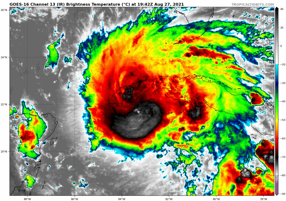
Satellite shows Ida continues to organize and produce persistent thunderstorm activity around her center.
Forecast:

The biggest change to this forecast is the intensity before and at landfall. Ida is now expected to hit near Houma, LA as a major category 4 hurricane with winds near 140mph and higher gusts. Expect widespread wind damage and power outages that will last several days to weeks.

Storm surge impacts have been raised as well. NHC now shows surge of 10-15 feet along the SE Louisiana Coast with 4-7’ in Lake Pontchartrain. There will be widespread flooding from the surge alone.
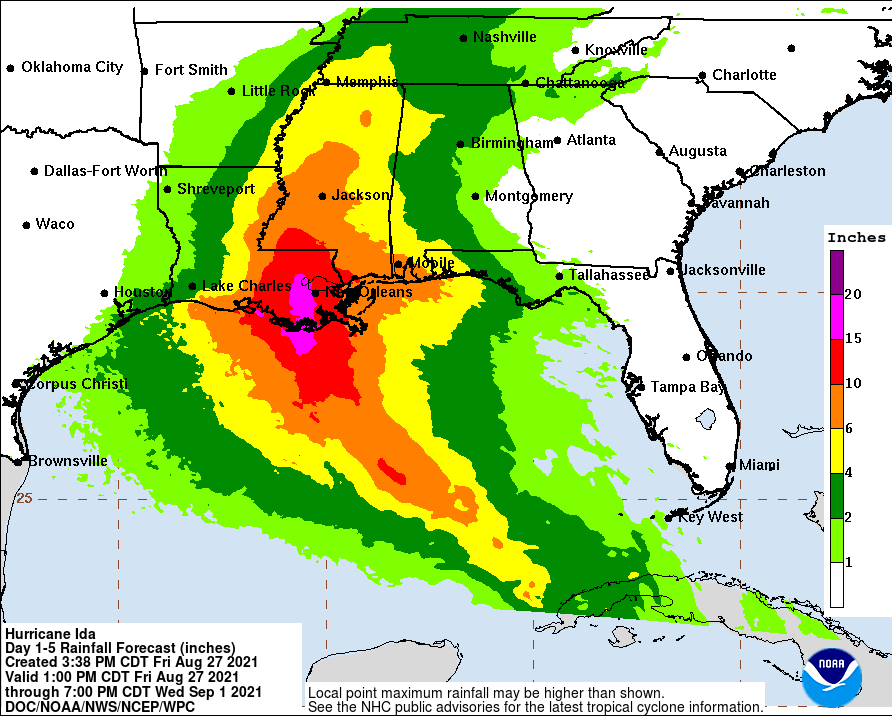
Rainfall amounts are still expected to range from a few inches to over a foot of rain across SE Louisiana.
It should be becoming increasingly clear for those in the path of this storm that you need to evacuate. The time to plan and take action is now. If you wait much longer you will likely find yourself stuck in traffic with thousands of others waiting till the last minute.
As always, Storm Guides is here to guide you and prepare you for what to expect. We are not in the business of hyping forecasts. We believe by us supplying you with this knowledge that we will help saves lives and give you the power to make sound decisions.