
2pm Update: Ida now a hurricane
Ida looks much better organized than she did even last night, and the storm has strengthened quickly this morning.
Current:
Ida is approaching western Cuba moving NW at 15mph and winds of 75mph. Pressure has fallen to 987mb which is nearly a 10mb drop from the previous advisory.

Satellite presentation has improved from yesterday. Remember how the circulations were tilted yesterday? Well thunderstorms have consistently been firing over the surface circulation recently which indicates the mid level circulation is lining up better. Ida is also breathing nicely on the eastern side of the storm as you can see from the clouds moving away from the storm.
Forecast:

There hasn’t been much of a change in the path. I have noticed a very small shift west in the NHC track and that comes in line with most model data as well. We’re still looking at a track to near Houma, LA on Sunday.

The bigger change has been the expected intensity at landfall. Yesterday the NHC had Ida as a strong category 2 at landfall. Now they have increased that to a middle end category 3 with winds up to 120mph.

I feel it’s important to at least mention that some models have also increased their thinking on intensity and some even show Ida becoming a category 4.
Impacts:
Winds will cause widespread tree and power line damage as well as some structural damage to homes. Mobile homes of any kind are not a good place to be. Expect the power to be out in the immediate area of landfall for several days.

Storm surge will be a big one with this storm along the SE LA Coast and Lake Pontchartrain. Winds will be blowing onshore and into the lake. 4-6’ of surge is expected for Lake Pontchartrain and along the coast we could see 7-11’ of surge.
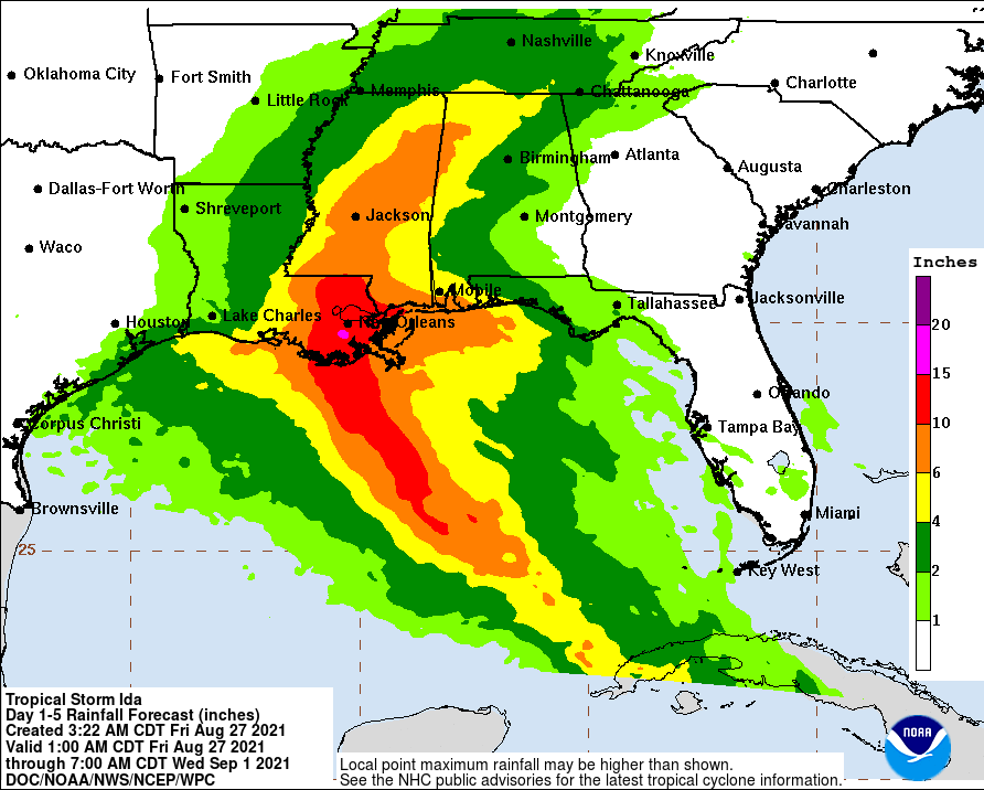
Rainfall will, of course, add an additional flooding threat to the storm surge. Several inches to more than a foot of rain will be possible across SE Louisiana. Where the heaviest bands of rain set up remains to be seen, but if you’re on the east side of the path you should be considering this.
People asking the “should I leave” question, ask yourself if you are prepared for several days without power in the summer heat. Do you have enough food and water for a week or more? What is your biggest concern? Storm surge, winds, trees falling on your house, flash flooding? Please take this information we’ve provided and apply it to your location. You, alone, know best how many risks you face in your specific location. We’re here to help guide you with any info you may need.