
Next big system develops on Wednesday
The next big weather maker for the eastern 2/3rds of the country gets going Wednesday across the Central Plains and could bring a few strong storms to the Southeast.
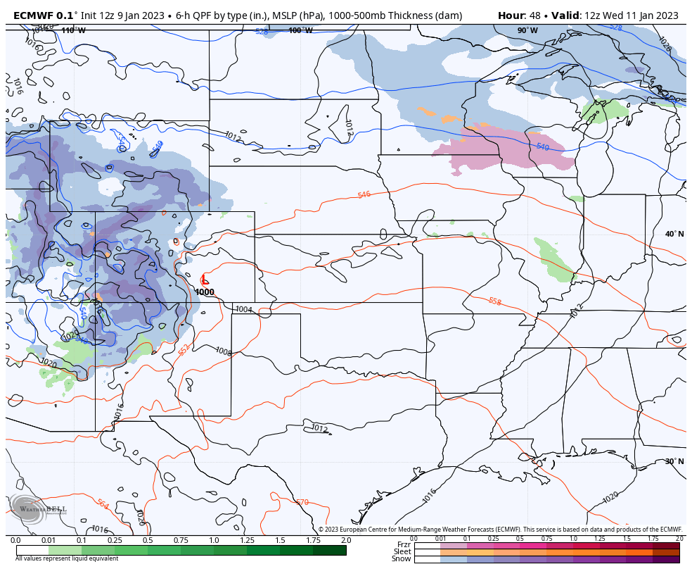
As noted above, a large area of low pressure first swings off the Rockies and then moves eastward and northeastward through the Plains and into the Great Lakes. Strengthening as it does so, it will kick off another soaker for the Deep South and bring some snow to areas further north.
SOUTHEAST REGION
Thursday night into Friday, according the EURO.
The southern side of this system will bring another round of rain and storms to the Southeast. This one doesn’t look nearly as bad as the past few severe weather events. So good news there! The EURO shows storms firing in Oklahoma, Texas, and Arkansas and then spreading east-southeast through the night and into Friday. We mentioned on Thursday last week that the ArkLaTex and surrounding areas would likely be highlighted for severe weather as the event got closer.
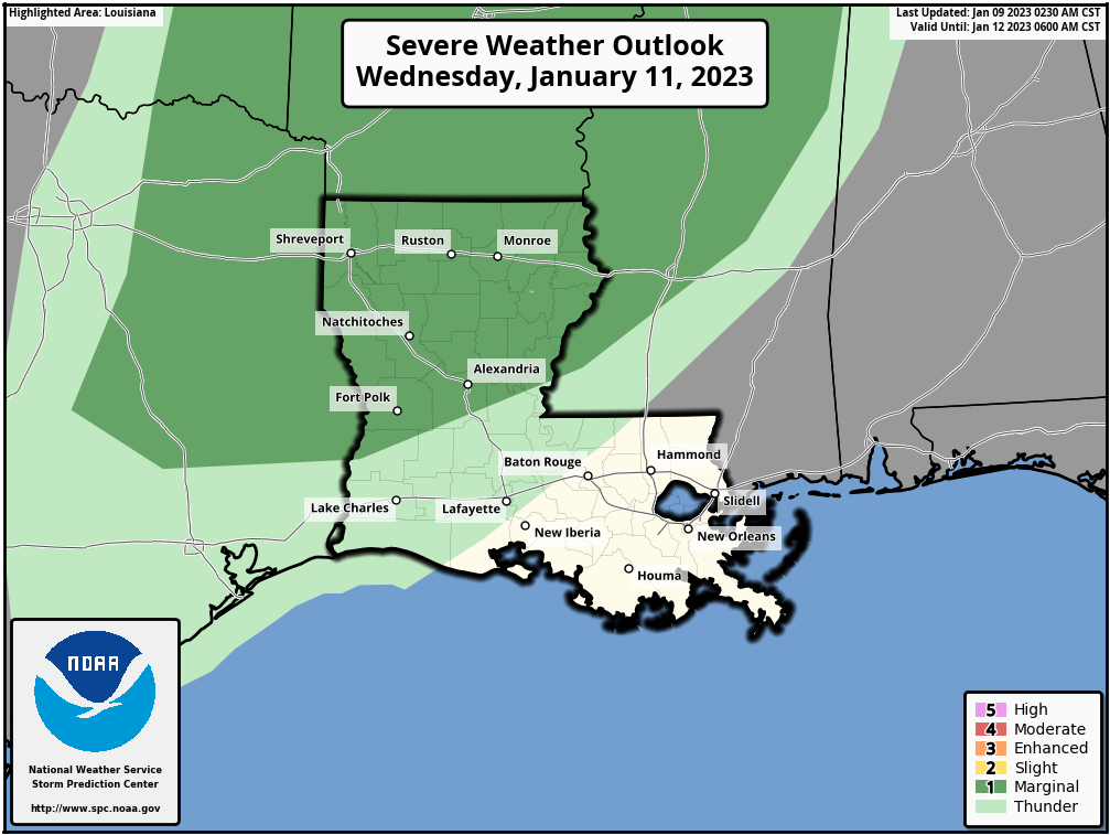
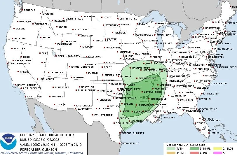
The Storm Prediction Center now has that and a large area of Arkansas and Mississippi also highlighted under a low threat for severe storms. It’s a 1 out of 5 on the scale right now. Perhaps we could see an upgrade to a 2/5, but overall I think given the timing of overnight storms and a relatively weak system as it comes through this part of the country, we should see lower threats than we’ve been used to lately. That doesn’t mean to completely disregard this event though! Stay prepared!
CENTRAL PLAINS
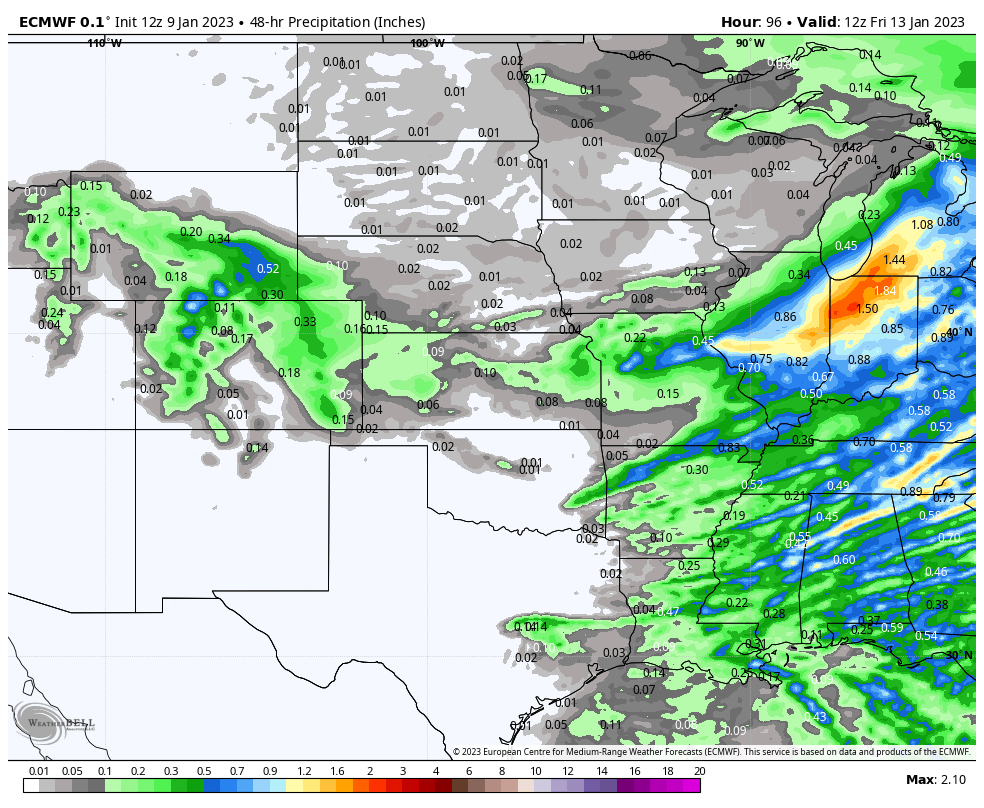
EURO Rainfall
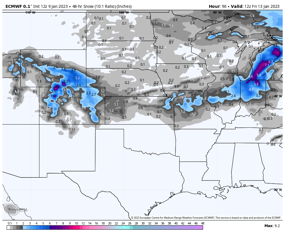
EURO Snowfall
This system will mostly swing south of Nebraska and Iowa. The majority of precipitation falls in northern Kansas and Missouri. Rainfall amounts will be pretty light and so will snowfall totals. I think areas through Kansas and Missouri see a lot of .5” of snow totals and a few spots that jump up to 2” in MO.
The system does continue NE from here and bring much larger snow totals to the Great Lakes and Northeast.
TEMPERATURES
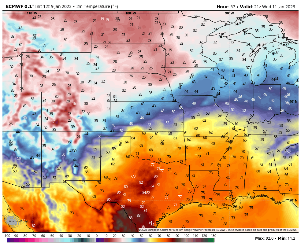
Temperatures Wed Afternoon

Temperatures Thur Afternoon
This system will pull down some colder air for both the Plains and the South. High temperatures go from the 40s in Omaha, NE on Wednesday to staying near the freezing mark on Thursday afternoon. Meanwhile, down south, temperatures will be some 20 to 25 degrees colder across Texas, Louisiana, Arkansas, and some of Mississippi.
Follow us on Facebook: https://www.facebook.com/StormGuides
Help us reach more people: https://stormguides.live/donate
Need a personalized forecast for an upcoming event or trip? We can help you make better plans!
Email us: https://stormguides.live/contact