
Severe weather & tornadoes expected today


As you can see from the radar loops going on above, it’s no surprise that severe storms are occurring now and will become more intense and widespread this afternoon and evening. The timing of the worst weather has slowed from yesterday which puts the worst of the storms in a slightly different area.
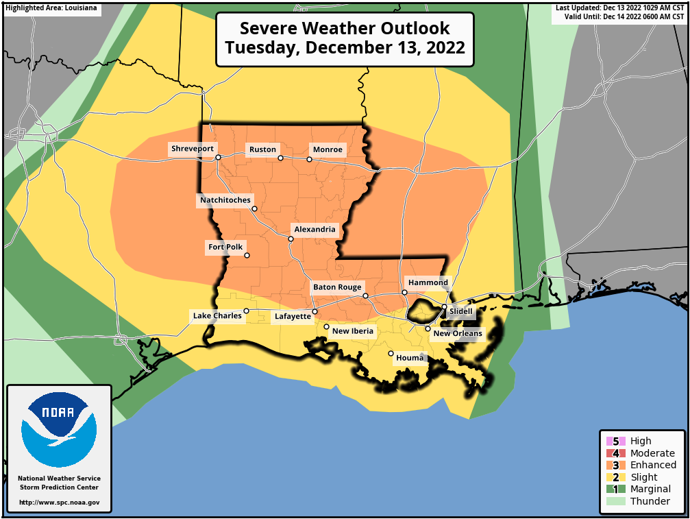
An Enhanced Risk (3/5) for severe weather for areas shaded in orange from E TX to Central MS which includes much of LA.
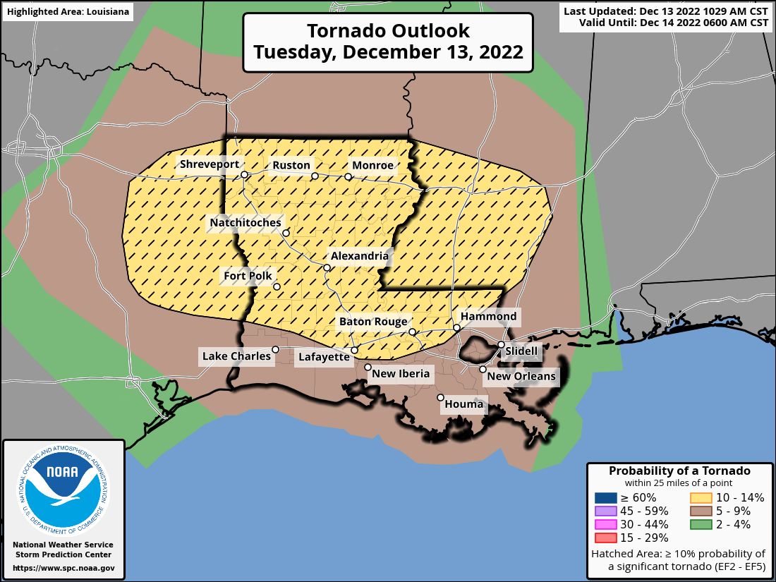
The highest chances of seeing tornadoes, including strong tornadoes, is in the hatched yellow areas stretching across LA from E TX to Central MS.
TIMING
As mentioned, this system has slowed a bit from yesterday’s thinking, and the placement of the strongest storms has shifted a little further west as well. Not good news for the ArkLaTex Region.
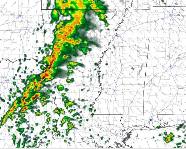
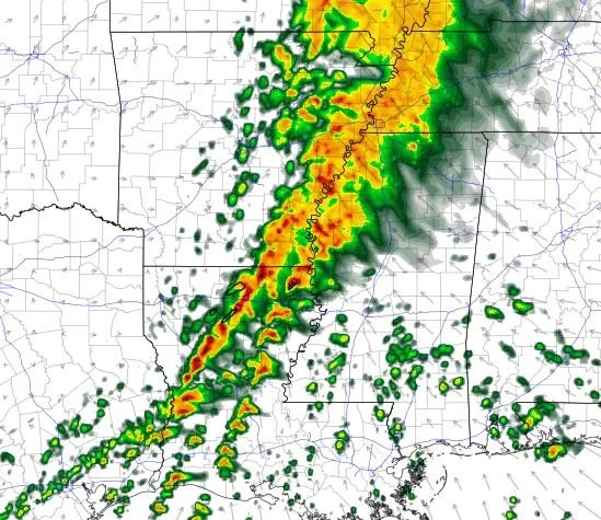
HRRR Model at 3pm
The storms across NE TX start taking on a more intense look and will kick off the next round of tornado potential as they move eastward.
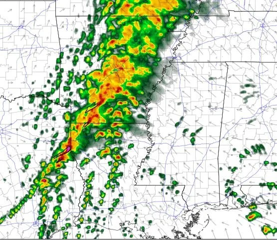
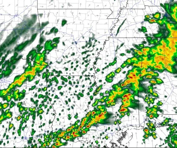
HRRR Model at 6pm
Tornado threat is nearing its peak for the Shreveport-Bossier Metro. No matter what, storms will produce heavy rain, lots of lightning, and overall some really nasty conditions. Damaging winds and hail are also possible.
HRRR Model at 10pm
By 10pm, storms are pushing away from the ArkLaTex and impacting the ArkLaMiss Region. Notice the broken line of storms ahead of the main line. This broken line from Lake Providence, LA to Monroe and down to just east of Alexandria will pose a tornado threat. The main line could also produce spin-up tornadoes, but damaging winds would be more likely.
HRRR Model at 6am Wednesdsay
Severe storms will continue overnight and into the morning for Central and South MS, and Southeast LA. Unfortunately, tornadoes, winds, and hail will still be possible. Due to timing and the fact that most will be asleep during this period, it’s very important you have a way to receive weather alerts that will wake you if needed.
We will be watching radar very closely for you all, and we are monitoring for launching the Live Weather Blog as storms become more troublesome.
If you’re new here (or not), please head over to our Facebook page and give us a like and a share! You can share this article or our whole page! Our goal is to guide you through the storm. We believe knowledge is power! The more knowledge you have, the less power a storm has over you!