
Tropical Update: Invest 92L and TD 2

Invest 92L remains about the same from the last update. Tropical Depression 2 will move away from the US.
TD 2:

I’ll give a brief update on this system. It’s off the coast of The Carolinas and moving away from the U.S. TD 2 developed quite the swirl overnight, but it’s moving into cooler waters and will likely weaken as it does. If the NHC does name the storm today, it will be Bill.
INVEST 92L: RIGHT NOW

This system hasn’t changed much since the update yesterday but global models continue to show gradual strengthening through the week. It’s worth mentioning that until 92L develops a solid center of circulation the forecast for this storm will be all over the place.
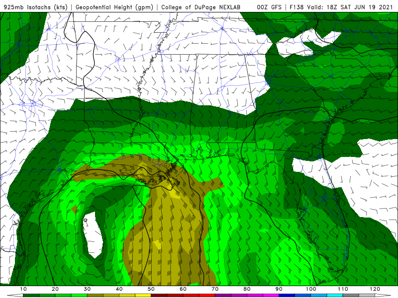
WHAT’S NEXT:
As mentioned above, models still advertise slow organization of 92L over the Gulf of Mexico this week as it slowly drifts northward.
The thinking is still somewhere between Houston and New Orleans between Friday and Sunday as a tropical storm.

You can see here that the spread in tracks generally takes the system northward towards the Gulf Coast.

Here is the latest intensity forecasts from various models. Most of which keep the system relatively weak.
POSSIBLE IMPACTS:
This will great change based on the eventual track of the system, but for now, here’s what we have.
It appears impacts will stretch far from the center of the storm with this one. As usual, the east side of the storm will be the rainy and windy side.

The GFS Ensembles show a swath of heavy rainfall across Louisiana, Mississippi, and Alabama through next Tuesday. Totals range from 2 - 5”.
Models are also showing winds in the range of 25 - 45mph. Winds will be an onshore flow, so we’ll watch coastal areas and flood prone areas for some increased water levels.
Stay with Storm Guides for future updates!