Looking Ahead
What We’re Seeing
We’re always on the lookout for the next storm. Check back daily to see what we’re seeing so you’ll always be ready for what’s coming across the horizon.
I-20 Rain
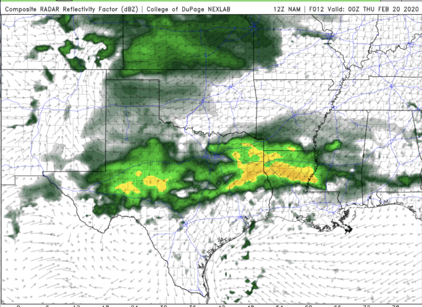
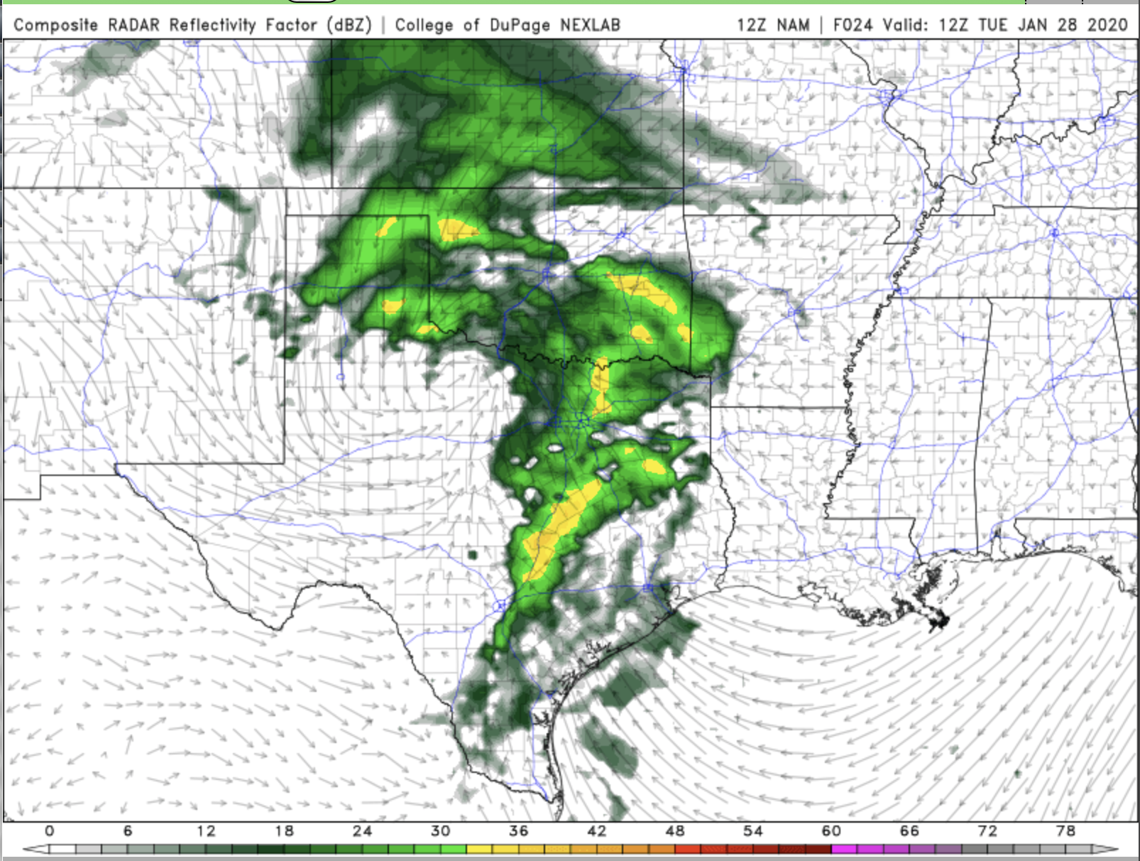
It’s going to be another wet day in much of the south, especially along the I-20 corridor. This map is from the NAM model showing the expected rainfall this evening. You can see heavy rain from West Texas, through Louisiana and into Mississippi. There is a risk for flash flooding as a result, especially from East Texas through Jackson, MS.
A small chance for a Big Bad storm
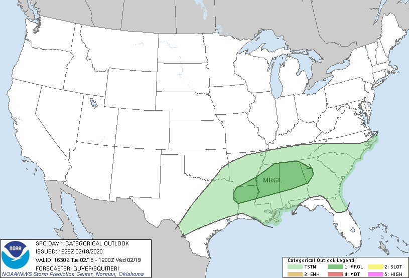
Heavy rain will be the main concern from the weather heading into this afternoon and evening, but there is a low chance of an isolated severe storm.
Rainy 30 Days
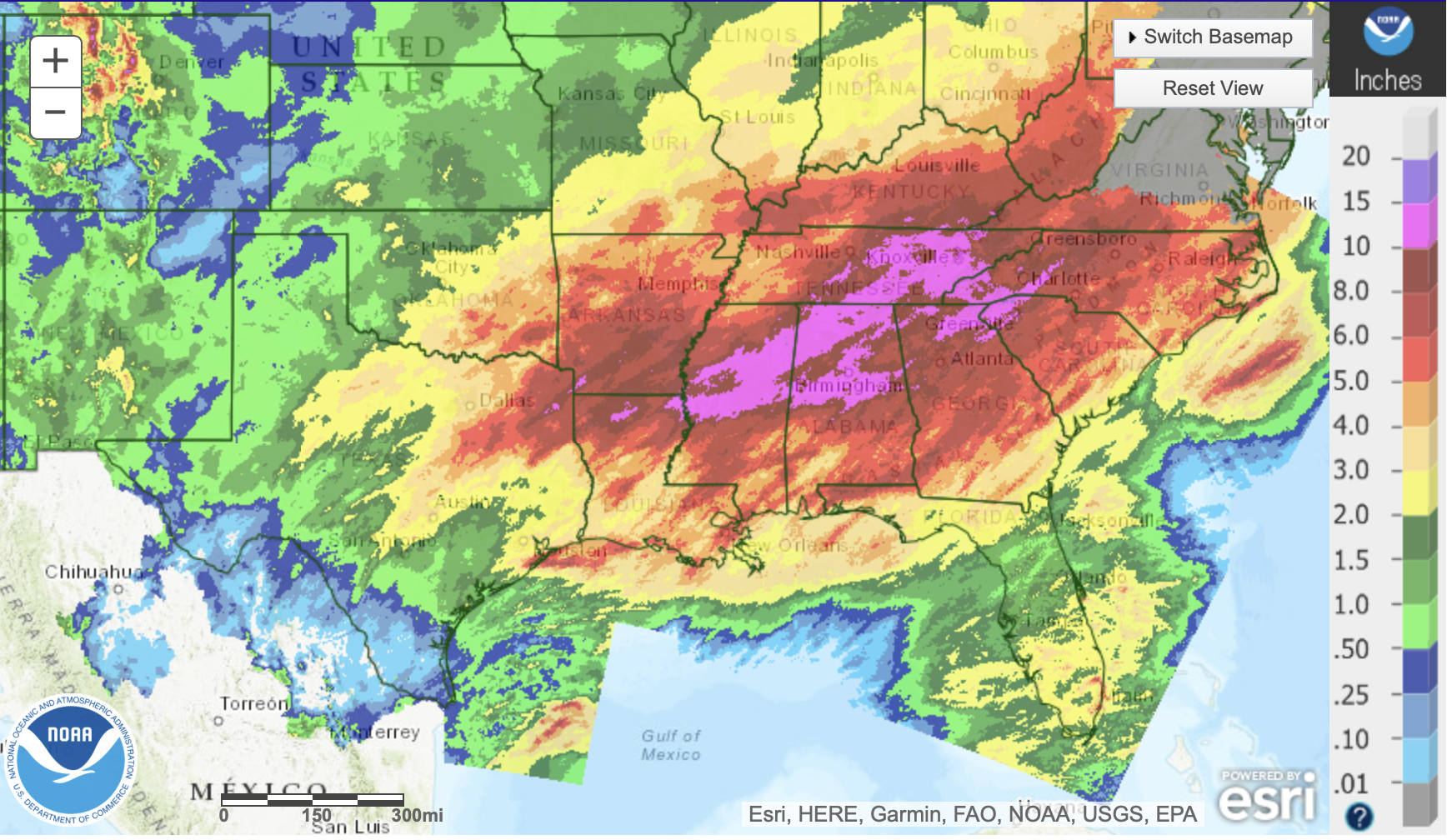
But, the purple areas in Mississippi, Alabama, and Tennessee have gotten between 10” and 15” of rain in that same amount of time. So, you can see why there’s been such a problem with river flooding in those areas, especially Jackson, Mississippi along the Pearl River.
Rain returns to the South
Rain returns to much of the Southeast and some of Texas on Tuesday.
Too Much Rain
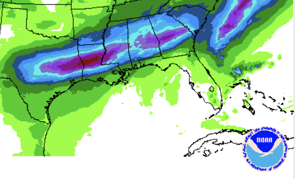
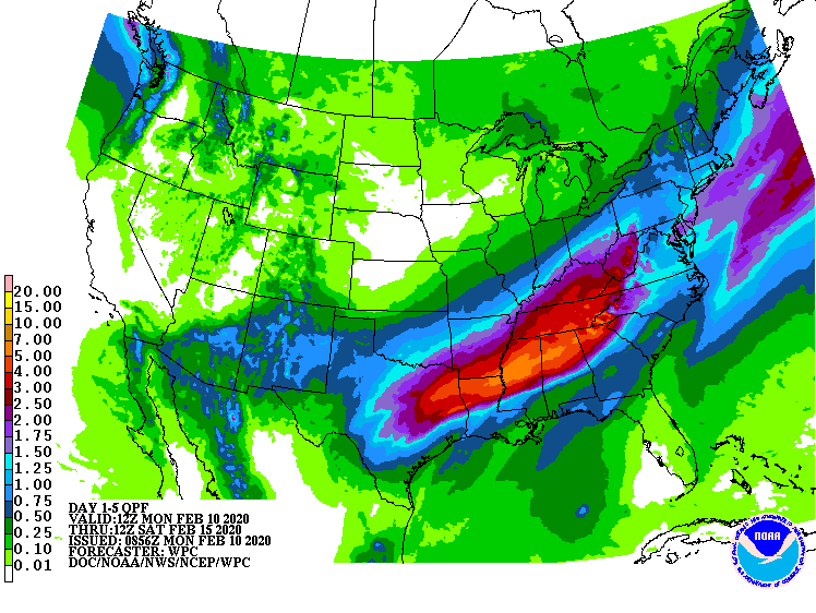
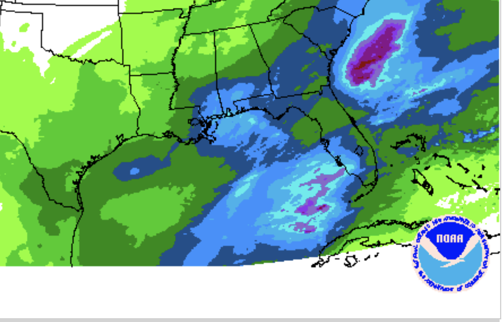
Unfortunately, those same areas that are already dealing with high streamflows are the exact same areas looking at more heavy rain this week. The image above is from the Weather Prediction Center’s Quantitative Precipitation Forecast for the next three days. We are expecting at least an inch of rain from Central Texas all the way to the Georgia - South Carolina border. But, then there are pockets where we’ll see more than two inches of rain from East Texas into Mississippi, and in Alabama into Georgia.
The science behind the sunny weather
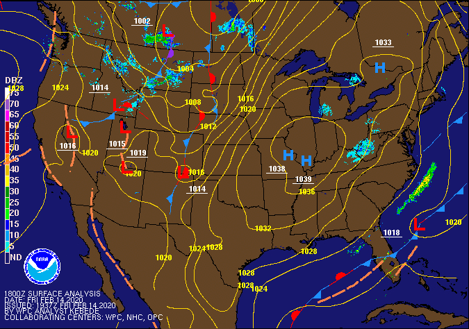
We’ve seen so many rainy days lately. So why, all of a sudden, has it been sunny? You can thank your calm and quiet friend: “the high.”
What is Zonal Flow?
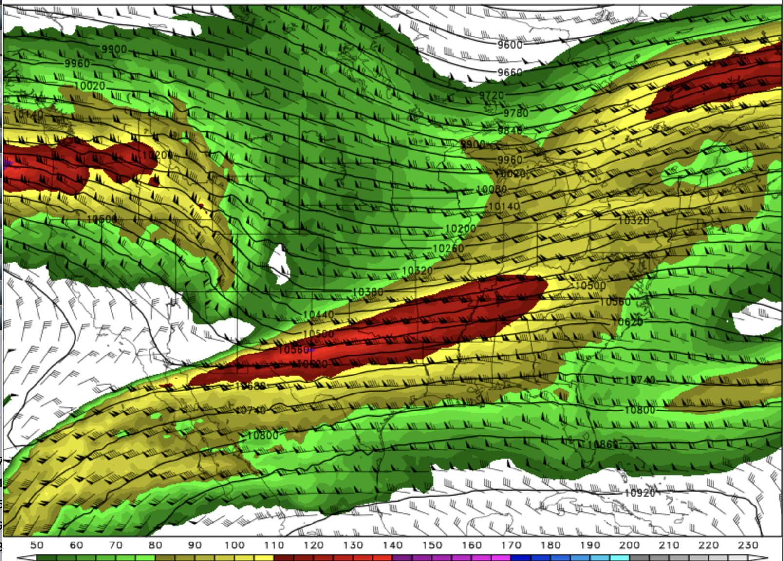
The jet stream also gives us a good look at where storms will develop and how strong they’ll get. When we’re looking for storms, we often look for bends in the jet stream. When you get a dip in the flow of those upper level winds, we call it a trough. As the winds curve around those bends in the air flow, they create spin in the atmosphere, and it’s that spin that can help create and strengthen storms here at the surface.
Florida Georgia Line of Rain
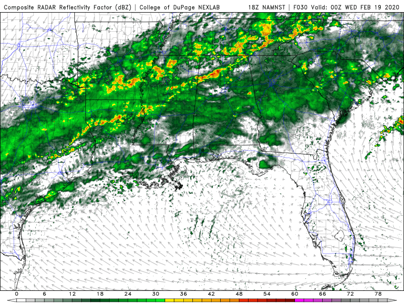
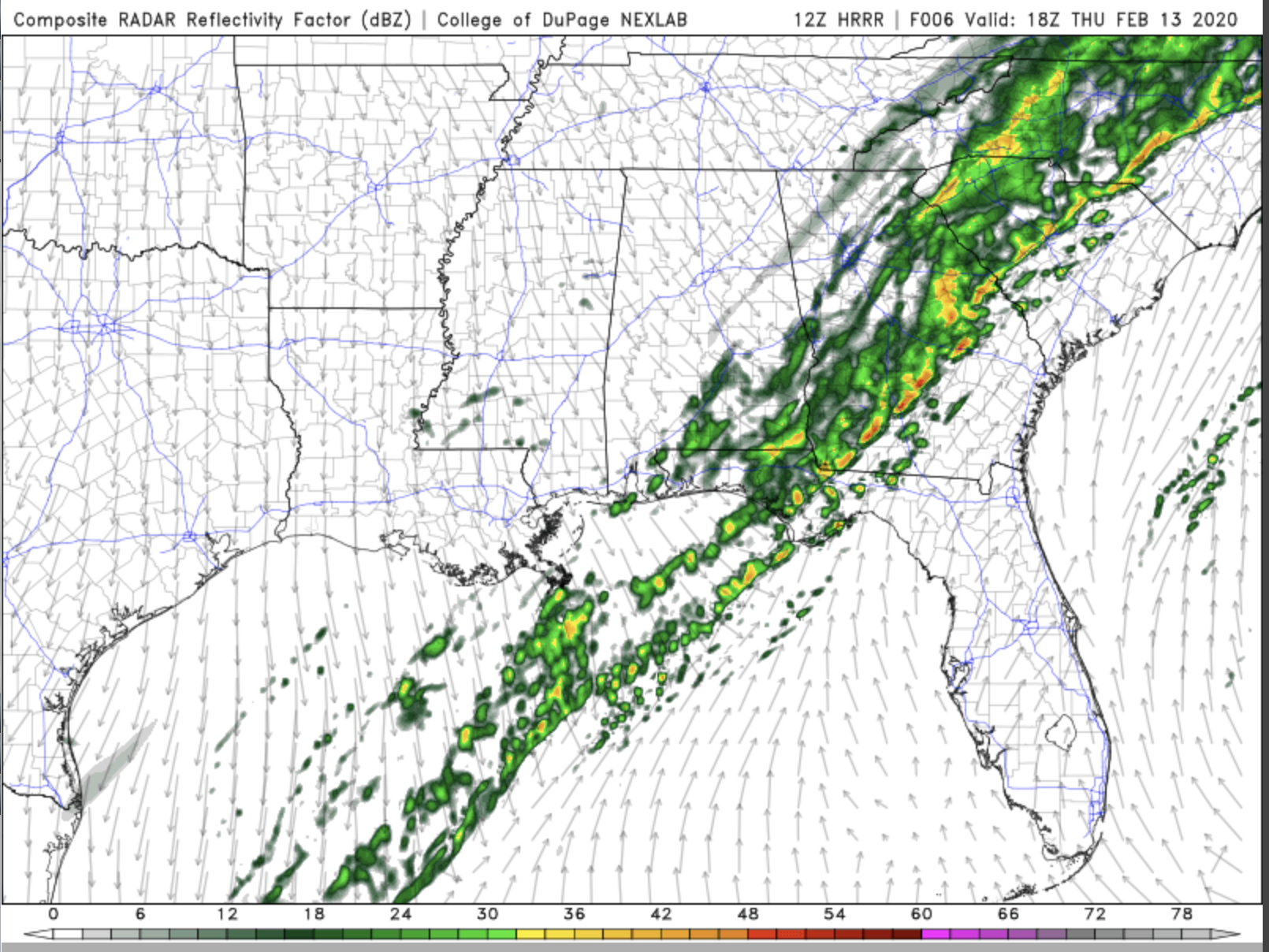
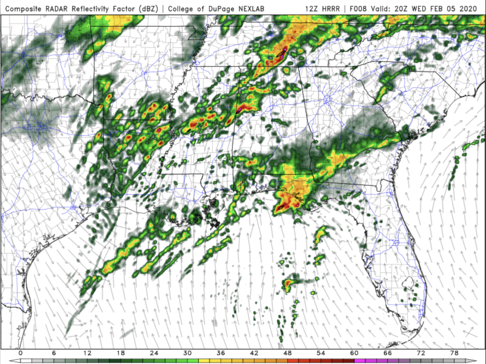
We do have a line of showers and storms that will be traveling through the Southeast U.S. today. The image above is the model output from the HRRR for around noon today. Notice the line of storms from the Florida panhandle, through the southeastern half of Georgia and into South Carolina. While we are expecting rain along with some thunder and lightning, it doesn’t look like there’s a big risk of Big Bad Storms today.
Quiet on the Storm Front
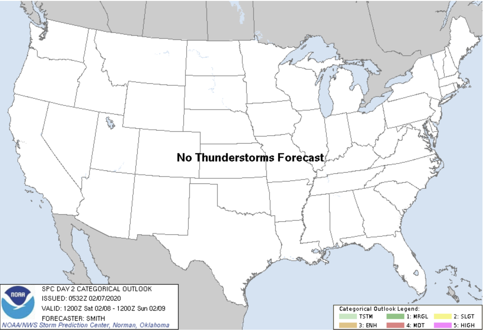
The next few days don’t really show much risk for storms anywhere in the U.S. We will see some showers developing towards the end of the weekend and into next week in Texas and Louisiana. We’re especially keeping an eye on a system that will swing through that area on Wednesday, February 12. Other than that, it’s looking pretty calm.
Deep South Storms
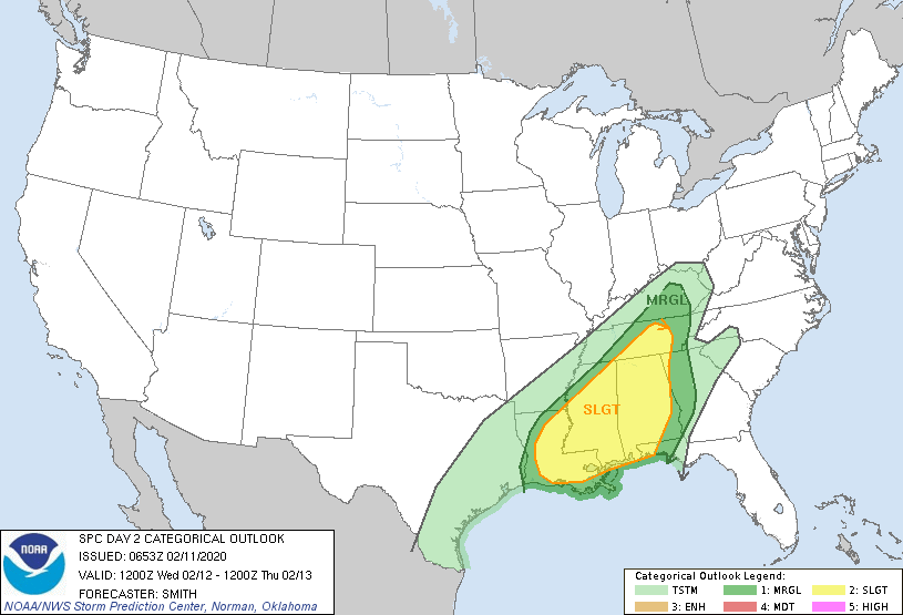
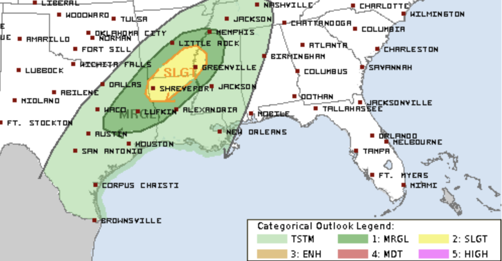
For the next two days, we are looking at a risk for Big Bad storms in the Deep South. However, the setup for each day is a little different, and that will bring different risks to different areas.
Winter in Dallas?
But, the big question I’m getting is, “Will Dallas actually get some snow?!?!?”
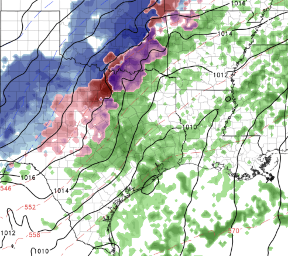
Sorry, but I don’t think so. Yes, there is a winter storm coming to parts of North Texas, it’s just further northwest of the Metroplex. Wichita Falls and Lawton are likely to see snow. Dallas and Denton, not so much.
Slight Chance for Days
It’s gotten unseasonably warm in these areas over the weekend. And, while the weather has felt amazing for the first of February, it also means there’s fuel for storms. Thunderstorms live off of heat and humidity, and we’ve added that into this mix.
3 Days Next Week
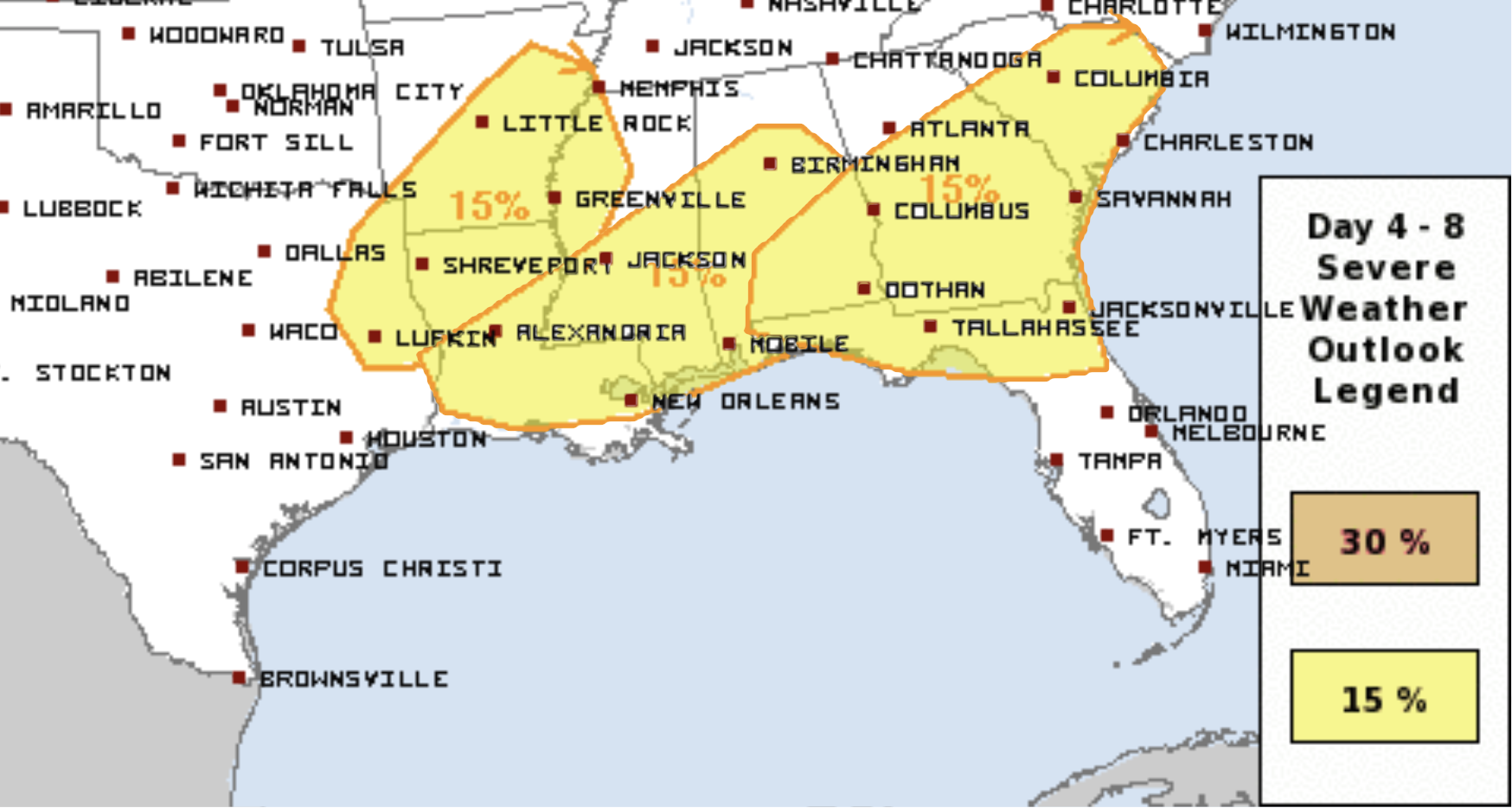
We’re also looking ahead to next week. A system will travel across Texas on Monday and start to tap into some moisture coming out of the Gulf of Mexico on Tuesday. As it swings across East Texas and begins its trek across the rest of the south, there is a chance the system could create some severe weather. That does include the possibility of tornadoes.
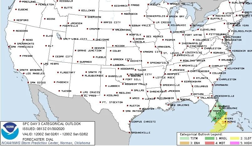
Some Storms Possible for South Florida
While the rest of The Deep South will just deal with some additional rain on Friday, there’s a small piece of energy that will take advantage of the warmer temperatures in South Florida to produce some storms.
Wet Along the Gulf Coast
This is today’s picture. It’s from the Weather Prediction Center run by NOAA. This is the Quantitative Precipitation Forecast for the next three days. It’s NOAA’s estimate of how much rain we’re going to get between now and the start of the weekend.
What is Dixie Alley?
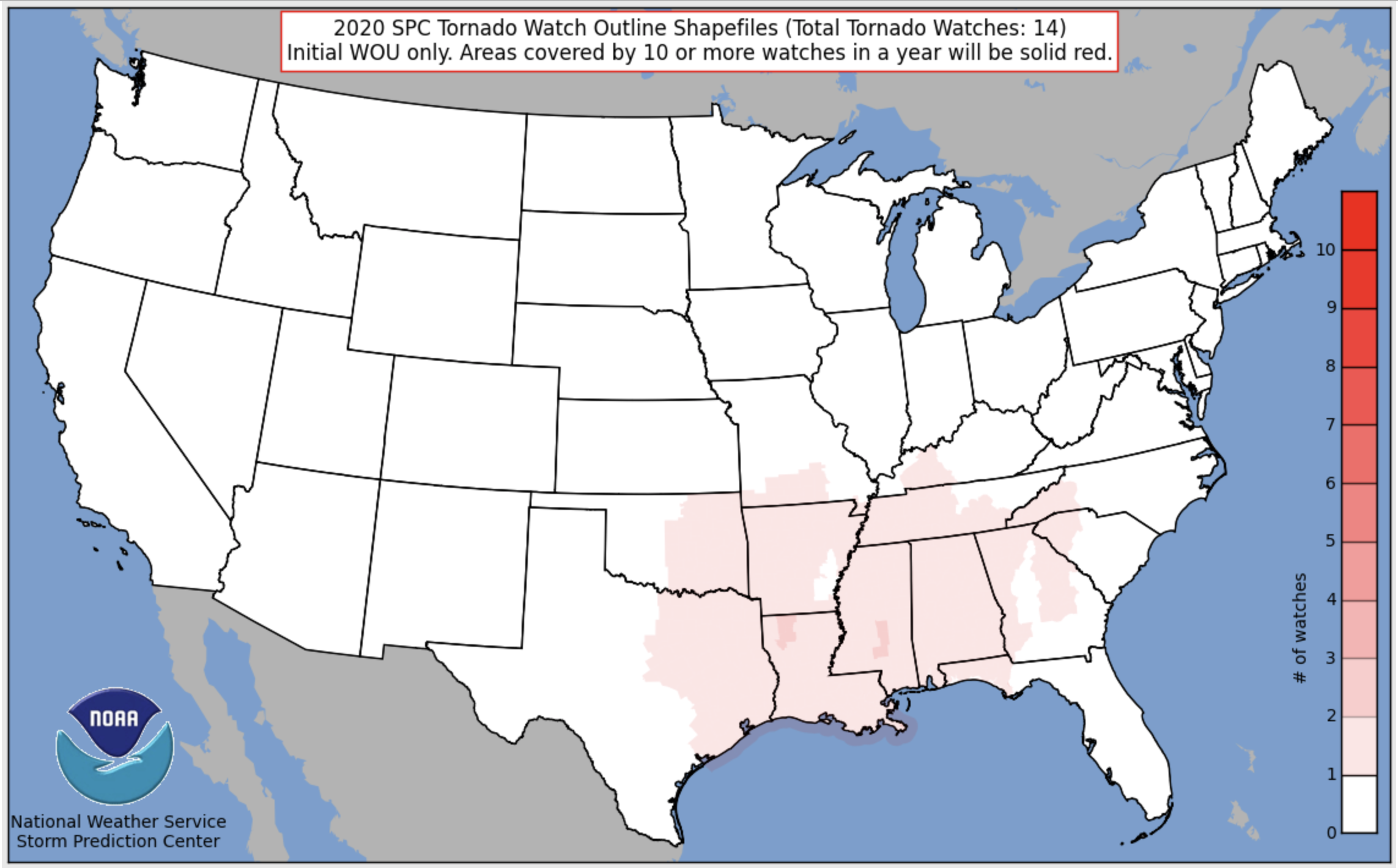
I’ve posted a picture from the Storm Prediction Center showing all of the locations where they have issued Tornado Watches so far this year. Since it’s currently late January, I thought this image did a pretty good job of showing you the physical location of Dixie Alley, and it makes it fairly obvious where the Alley gets its name. It runs right through the heart of Dixie!
Texas Rain
It’s a good thing it’s not late spring. I say that because if it were - if temperatures were about 20 degrees warmer - this system that’s going to go across Texas tonight and into the South Tuesday and Wednesday would be a big problem. But, since it’s not warmer, then it’s not going to be as big of an issue to deal with.
Help us help more people.
We will never charge you for the potentially life saving information we share in our Big Bad Weather Blog. But, it does cost us time and money to do. So, if you would like to see us reach more people in more places, please click this button.

