

Looking Ahead
What We’re Seeing
We’re always on the lookout for the next storm. Check back daily to see what we’re seeing so you’ll always be ready for what’s coming across the horizon.
Laura Inland Over Louisiana
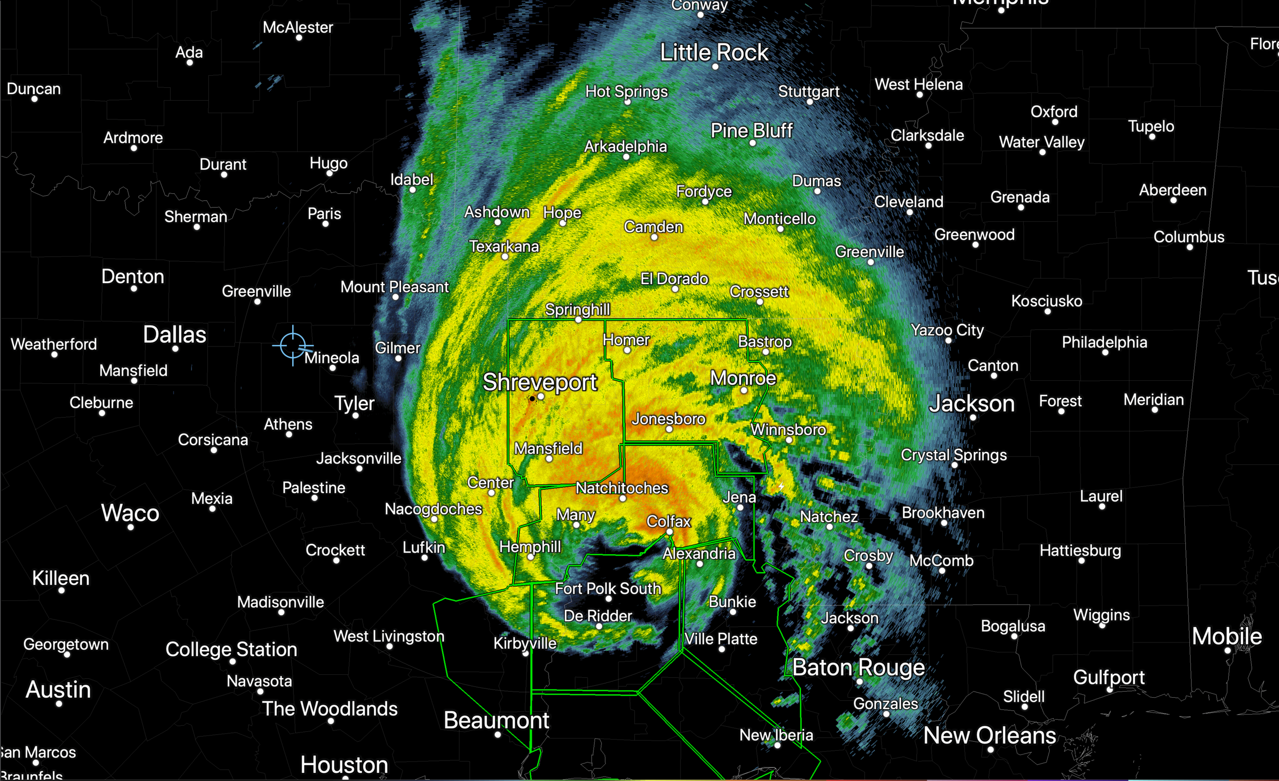
Hurricane Laura made landfall around 12:20 AM at Cameron, Louisiana with sustained winds of 150 mph. Laura was a Cat 4 Major hurricane when she came ashore and has been able to maintain a significant amount of her strength. As of 8 AM, she was still a Cat 2 Hurricane with sustained winds of 100 mph.
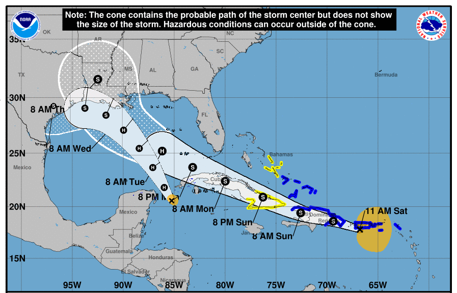
The Latest on Laura
Laura has gotten stronger over night last night, and should continue to strengthen through the day today. We’re expecting her to reach Cat 3 before starting to weaken just before landfall. Then, after making landfall, Laura should weaken pretty quickly as she loses her source of fuel over land.
Laura forecast to become a major hurricane
Laura on approach to the Texas/Louisiana line. Now is the time to finalize plans.
Marco Fades, Laura Perseveres
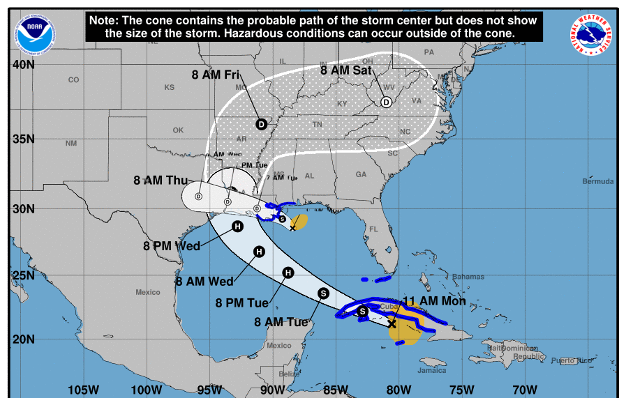
Marco is no longer a Hurricane, and is fading fast. As we talked about last night on our Facebook Live Prep Talk in the Big Bad Storm Blog, the upper level low pressure center of Marco is being ripped away from the lower level center of rotation. As a result, Marco is losing its intensity pretty quickly. The NHC forecast above has Marco as a Tropical Depression all the way into East Texas, and almost getting to Waco. No way. I’d be surprised if we could even label Marco as a Remnant low as far west as Jasper.

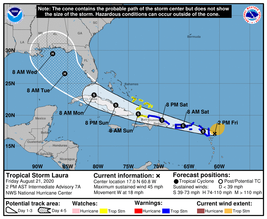
Laura and Marco: Model Agreement
This morning, it’s finally looking like we have some clarity on what Laura and Marco are going to do. In yesterday’s post, I was critical of how the NHC handled their forecast products on these two storms. Today, I think these are pretty good.
Laura and Marco: 2 Options
This is one of the most difficult tropical forecasts I’ve ever worked with. We’ve been saying from the beginning that the models don’t have a good understanding of these systems and what they’re going to do. Models are always wrong - every single time. The key to being a good forecaster is figuring out why they’re wrong, what degree they’re wrong, and correcting for it. So, that’s what we’re going to try to do for you in this blog post.
Watching Laura and TD 14
Two tropical systems in The Gulf this weekend? It’s possible, but here’s why we’re not panicking yet.
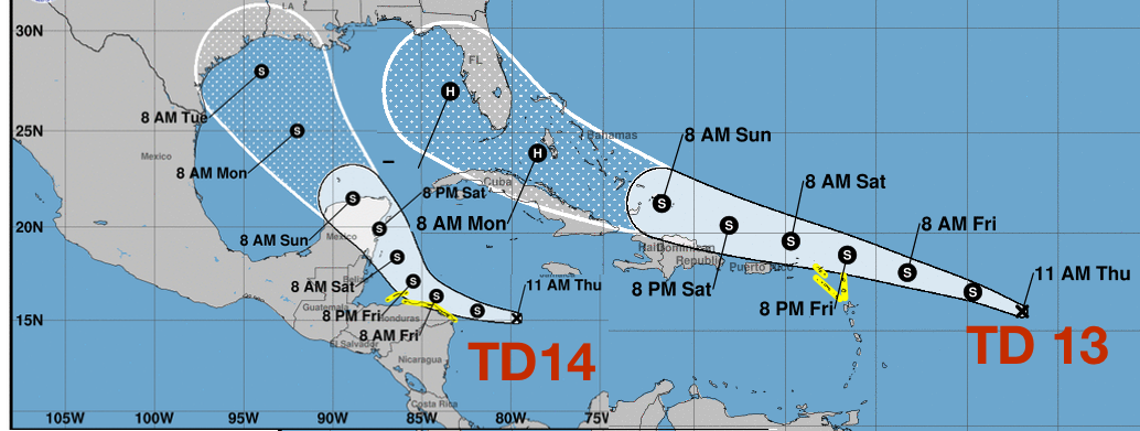
Two Tropical Depressions
The National Hurricane Center has labeled two new Tropical Depressions. TD 13 in in the Atlantic east of the leeward islands. TD 14 is in the Caribbean between Jamaica and Nicaragua.
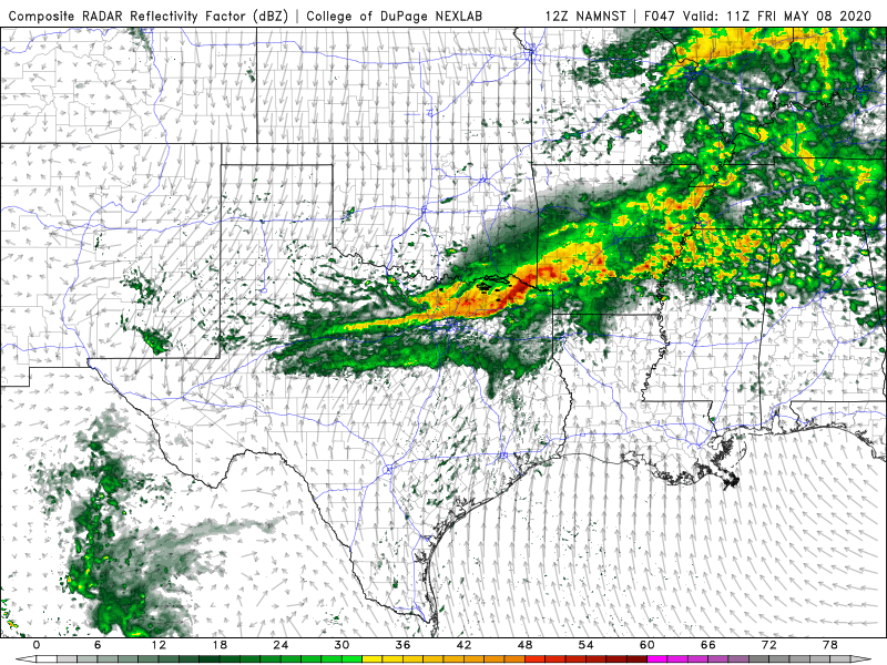
TD8 Update
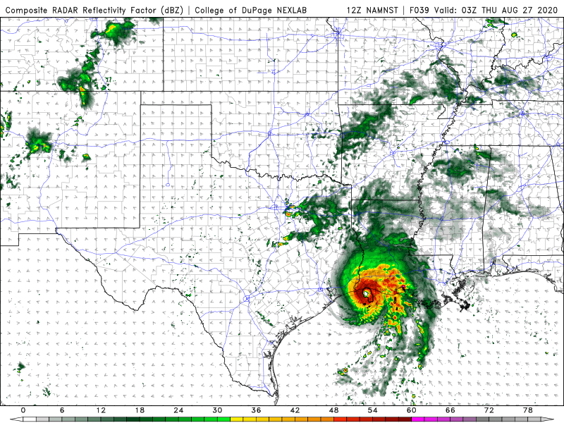
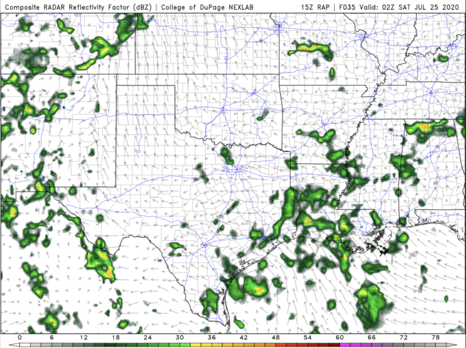
The picture above is the Simulated Reflectivity output from the North American Model for Friday evening. You see the blob of rain near the South Texas Coast. That’s the center of TD8, but you’ll also notice there’s not a lot of organization with it.
Cristobal Makes Landfall Today
Cristobal will make landfall today south of New Orleans. The animation above is a pretty good depiction of what we’re expecting this storm to do. Notice how it makes a little jog to the left, but keeps on trucking north. Also notice most of the heavy rainfall remains on the eastern side of the storm. That’s the area that has the greatest potential for some quick spin-up tornadoes as Cristobal moves inland.

Positive Signs: Cristobal Update
The good news is Christobal remains rather disorganized, but you should still be paying attention.
Positive Signs: Christobal Update
In the latest update, there’s more good news than bad. It’s looking like we can eliminate more locations as landfall targets and it’s looking like the potential for massive flooding is decreasing.
Narrowing the Target
As a meteorologist, when I’m working on predicting the future path of tropical systems, it’s helpful when the computer models start to fall into agreement. That appears to be what the models are doing today.
Here are the key points the various models appear to be agreeing on today.
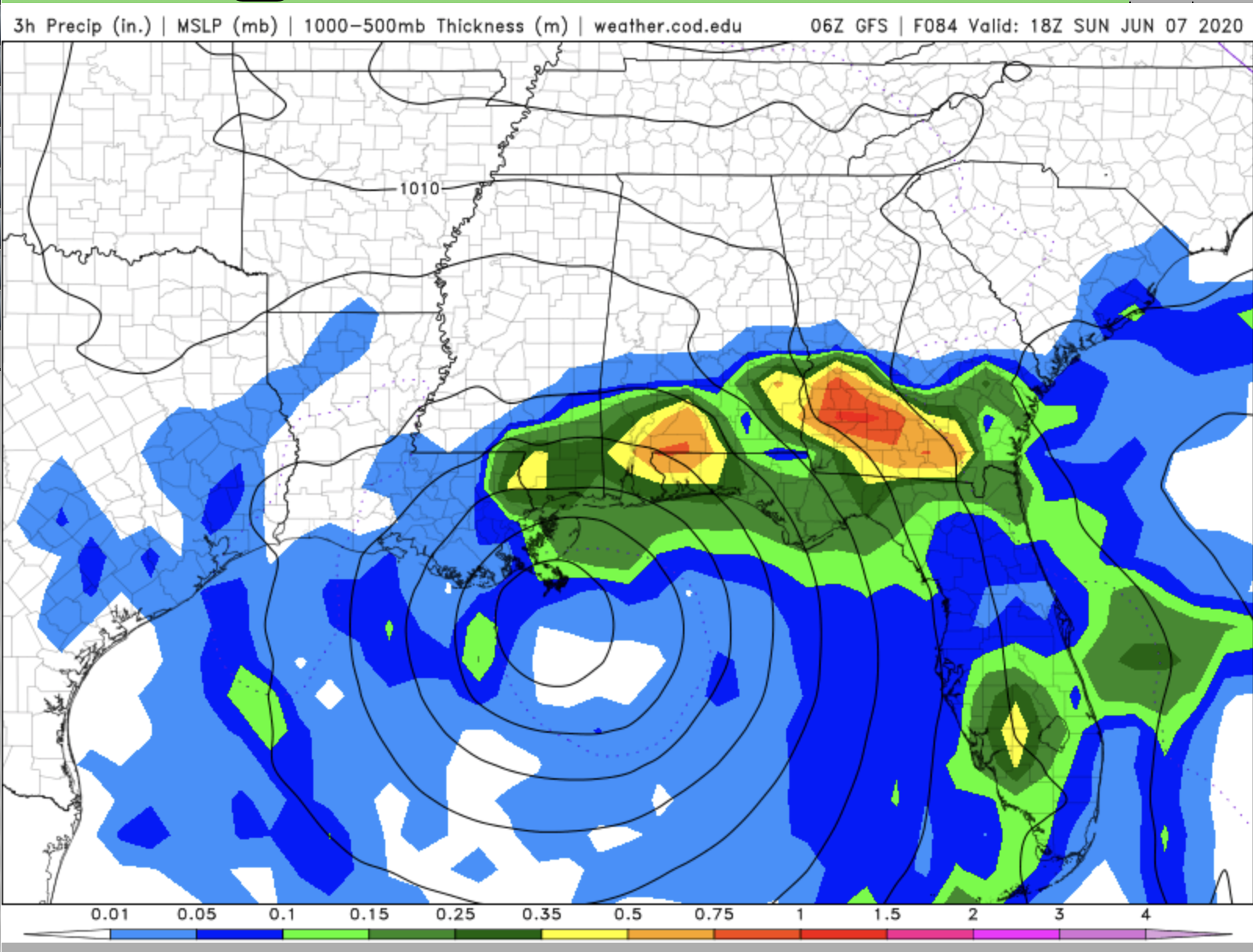
First Gulf Storm
Right now, landfall looks like it will be between Houston and New Orleans on Sunday. It’s still several days out, and a lot can change over that time, so we’re really just trying to tell people to start paying attention to this system and make sure you have your hurricane plans and supplies ready.
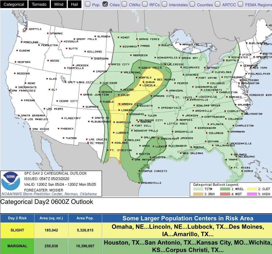
Isolated Big Bad storms for Sunday
It’s not the worst setup we’ve ever seen, but there’s a small chance for a few Big Bad storms Sunday.
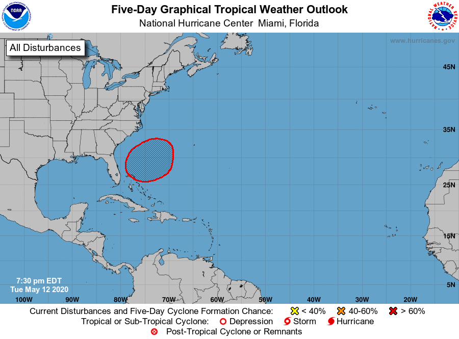
Watching the tropics…already?
It’s true! We’re watching a system for tropical development for the weekend.
Strong cold front with some storms
We’re still tracking a strong cold front set to swing through the south on Friday.
Relief from the heat later this week
A cold front will bring high temperatures some 5 - 10 degrees below average by the end of the week.
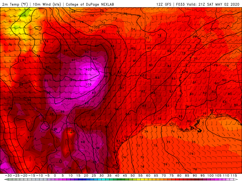
A weekend warm up
A taste of summer time temperatures is setting up over the weekend and into early next week.
A welcomed quiet stretch
Folks in the south are finally getting a break from Big Bad storms.
Help us help more people.
We will never charge you for the potentially life saving information we share in our Big Bad Weather Blog. But, it does cost us time and money to do. So, if you would like to see us reach more people in more places, please click this button.