

Looking Ahead
What We’re Seeing
We’re always on the lookout for the next storm. Check back daily to see what we’re seeing so you’ll always be ready for what’s coming across the horizon.

Tropical Update: Invest 92L and TS Bill
Tropical Storm Bill formed overnight and Invest 92L continues to churn over the Bay of Campeche.

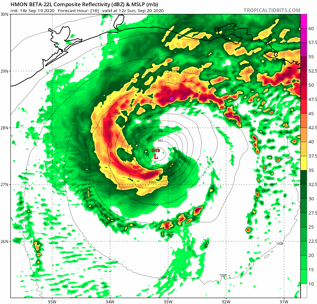
Tropical Update: Invest 92L and TD 2
Invest 92L remains about the same from the last update. Tropical Depression 2 will move away from the US.

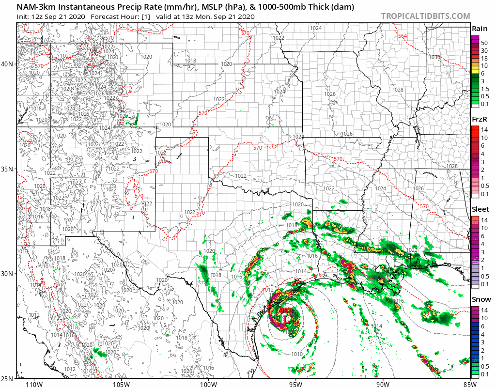
An update on Invest 92L
The southwest Gulf of Mexico is coming to life and you’re probably seeing a ton of hype about this system. Let’s catch you up!

Tropics waking up and bringing more rain this weekend
What this system will do, regardless of development, is produce more rain over areas that have already seen so much this week.
Active weather expected again this week
Another busy stretch of weather starts Monday afternoon across a portion of Oklahoma and into North Texas.
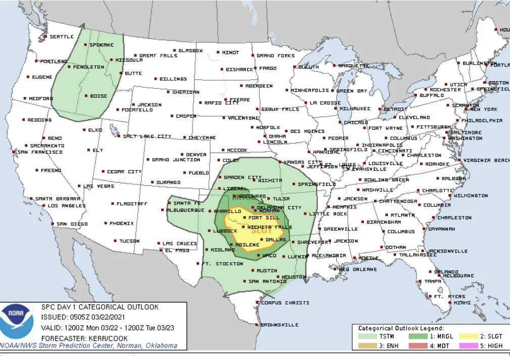
A multi-day severe weather outbreak starts today
A very strong storm system has kick started the 2021 spring severe weather season and will bring widespread big, bad storms over the next 3 days.
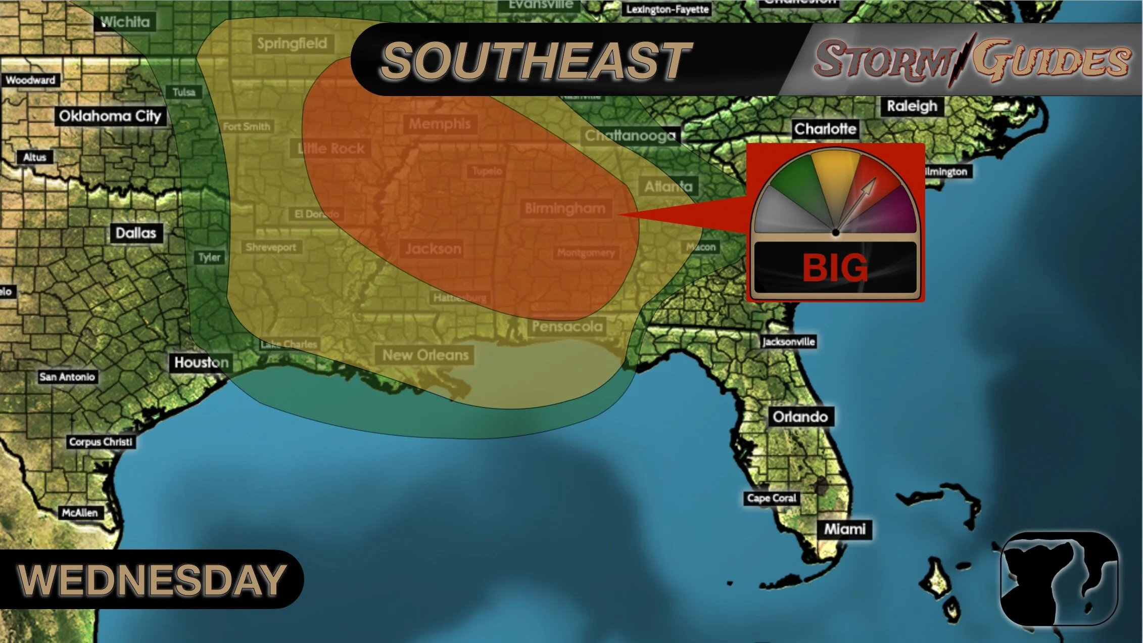
Low end severe threat for ArkLaTex
Some isolated small hail or damaging wind gusts could be possible.

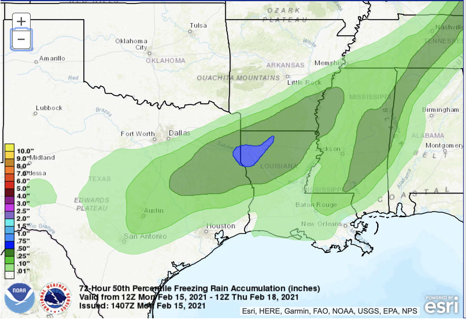
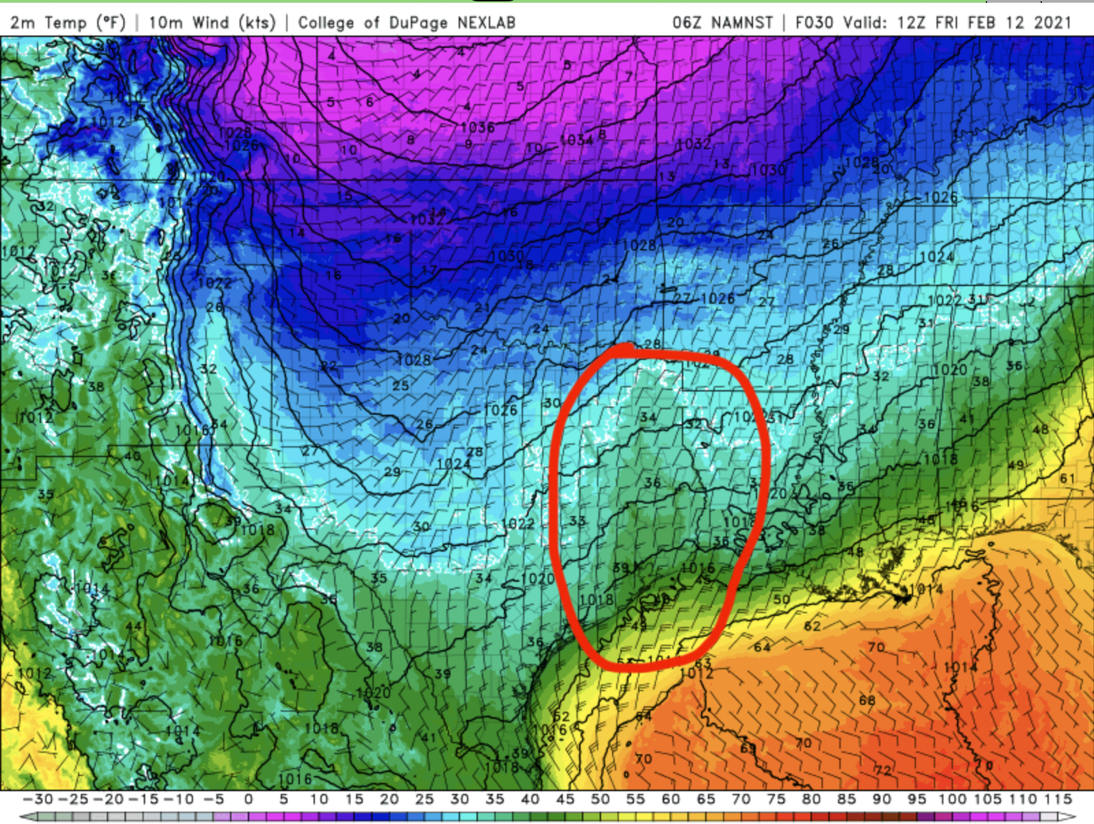
How Much Ice
All three of these models are showing a band of ice running from Central Texas, to the Gulf Coast, and up through Louisiana and into Mississippi. They are also all three showing a bulls-eye of ice accumulation greater than half an inch from about Lufkin, TX, into Louisiana, including Shreveport, Natchitoches, Alexandria, Ruston, and Monroe. That would be enough ice to bring down power lines and tree branches.
In short, the forecast is still calling for a big, fat, cold mess.

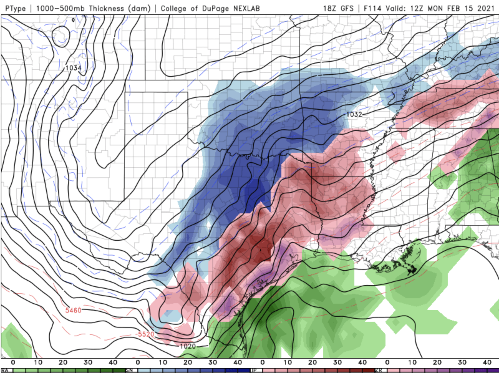
Ice Storm Cometh
There’s really no change to the thinking behind the forecast for this next wave of winter weather across the south central U.S. This is going to cause more problems in more areas than the snowfall on Sunday. The main reason for that is while temperatures at the surface haven’t yet climbed back above freezing in most of Texas and Louisiana at the surface, they are climbing back above freezing about a mile up in the atmosphere. So, that means that the precipitation that falls through the sky will first melt into water, and then instantly freeze once it hits the ground, or tree limbs, or power lines.
One More Pass
Most people in Texas and Louisiana woke up to at least a dusting of snow on the ground, went outside, took pictures, posted them to Facebook, and promptly went back inside. Good plan!
But, we’re not done yet. There’s one more winter storm coming through Texas, Oklahoma, Arkansas, Louisiana, and Mississippi this week. And, this one looks like it could cause more trouble, especially for power outages and damage to trees.

Valentines Day Winter Weather
The general rule for all of these areas, is if you can, don’t leave home. Most people who live in this part of the country have no idea on how to drive in this type of weather, and that makes travel more dangerous for anyone else out on the roads. You need to be prepared to lose power, especially in the places that are looking at the threat of freezing rain. And, don’t expect for this to clear up quickly. We stay below freezing in most of these areas until at least Thursday afternoon.

Lovely Winter Weekend
Yes, Valentine’s Day is coming, but so is a wintry mix, and frankly, more of a wintry mess in many areas.
What’s more, it’s not just one pass. We’re getting several winter storms over the next 6 days.
Winter Storm Update
There’s not much change this morning to the forecast. We are still expecting wintry weather in Texas and Louisiana, and all of the states north this weekend and into next week. This will be a mixed event. Snow, rain, sleet, freezing rain will all be occurring in different places throughout the next 7 days.
A Series of Winter Storms
This is going to get complicated.
We are looking at a series of winter weather events to swing through Texas and Louisiana this weekend and into next week.
Let’s start with Thursday.
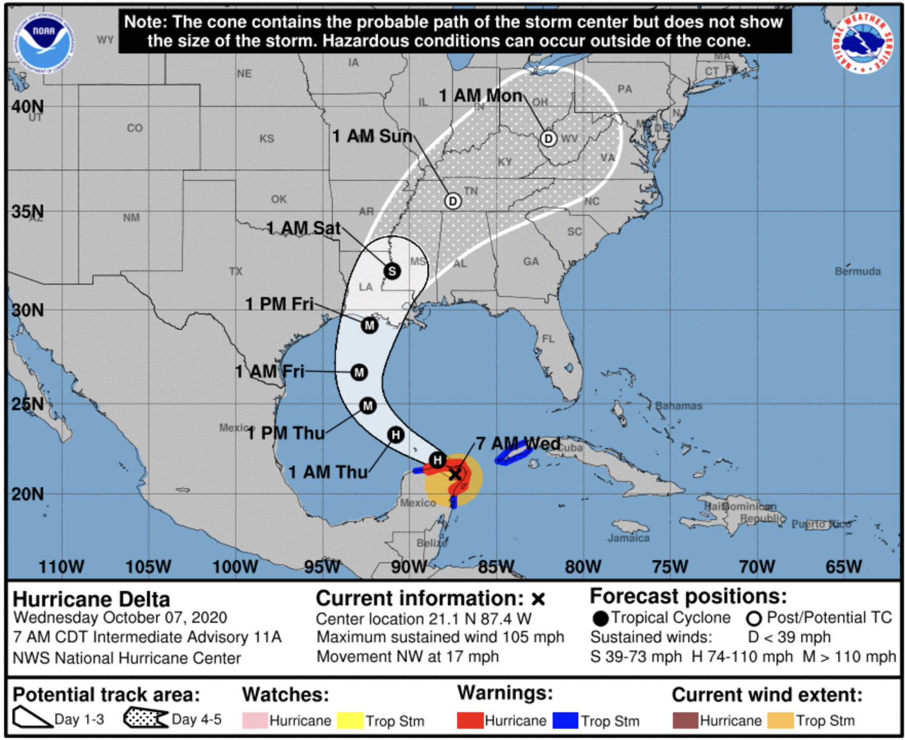
Delta Coming Ashore
Hurricane Delta is coming ashore today in Southwest Louisiana, in almost the exact same place that Hurricane Laura did back in August. Some people just got power back two weeks ago after Laura, and now run the risk of being in the dark again for an extended period of time.

Delta Shifts West
Unfortunately, the latest track from the National Hurricane Center is a little further west than yesterday. I say “unfortunately” because that means this storm is more likely now to travel over some of the exact same areas that were devastated by Hurricane Laura earlier this season. Some people in southwestern Louisiana just got their power back on last week, and are now looking at another storm heading their way.
Delta Dances Towards Louisiana
Hurricane Delta is traveling over the tip of the Yucatan Peninsula this morning. She’s headed towards the Gulf on a northwesterly path. For the next 36 hours, it will look like Delta has a bullseye towards Houston if she just keeps on a straight path. But, one of the truisms about weather is that storms don’t usually stay on a straight path. They like to turn and bend, and that’s exactly what we’re expecting from Delta.
Beta’s Landfall
Tropical Storm Beta is inching nearer to the Texas coast around Corpus Christi. She’s still expected to make landfall later today or very early on Tuesday. The whole idea that Beta bounces along the coast is still in play, and the NHC has decreased the area of the forecast cone that gets very far inland.

Beta Bounce Continued…
Now, here is where the forecast has changed a bit. This is the WPC Quantitative Precipitation Forecast for the next 5 days. While is is still showing areas of more than 10” of rain between now and Friday morning, that area is much smaller than yesterday’s forecast. Plus, the area of 6”-10” of rain is smaller as well. This is a positive sign, especially for people in Southeast Louisiana who are still without power from Hurricane Laura. It means the risk of widespread flash flooding is going down. It hasn’t gone away, but it’s trending in the right direction.
Beta Bounce
This GIF above is the HWRF tropical model. Notice it takes the center of the storm right over Corpus Christi, TX, but then bounces Beta back out to sea. That bounce may be a little overdone, but the idea has merit. Beta has a real problem after making landfall. Several of the models take the upper level center of rotation off towards the northeast, but the lower surface level rotation gets stuck by a surface high in Central Texas. It should eventually turn towards the Lake Charles area as a Tropical Depression, or maybe a weak Tropical Storm by late next week. But, that separation from the lower and upper level rotations will prevent the storm from getting stronger.
Help us help more people.
We will never charge you for the potentially life saving information we share in our Big Bad Weather Blog. But, it does cost us time and money to do. So, if you would like to see us reach more people in more places, please click this button.